Tumalo Falls Hikes & Tips for Visiting
This post may contain affiliate links.
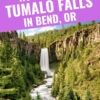
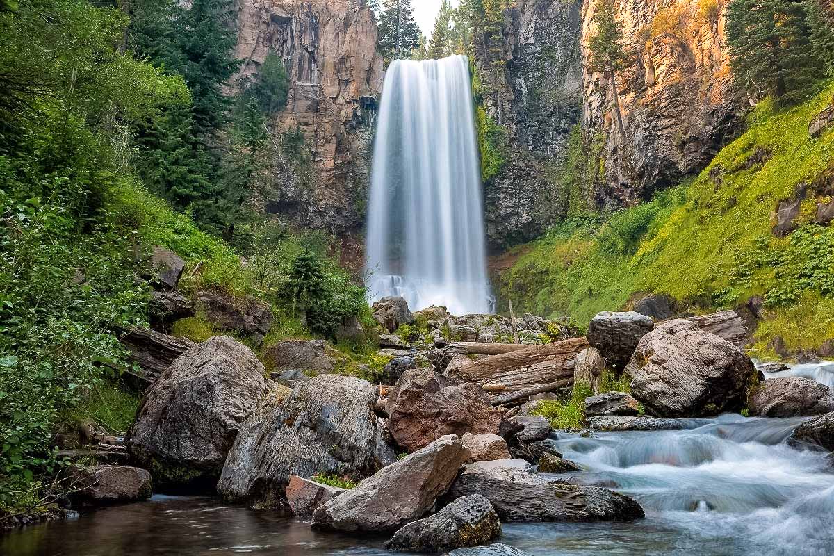
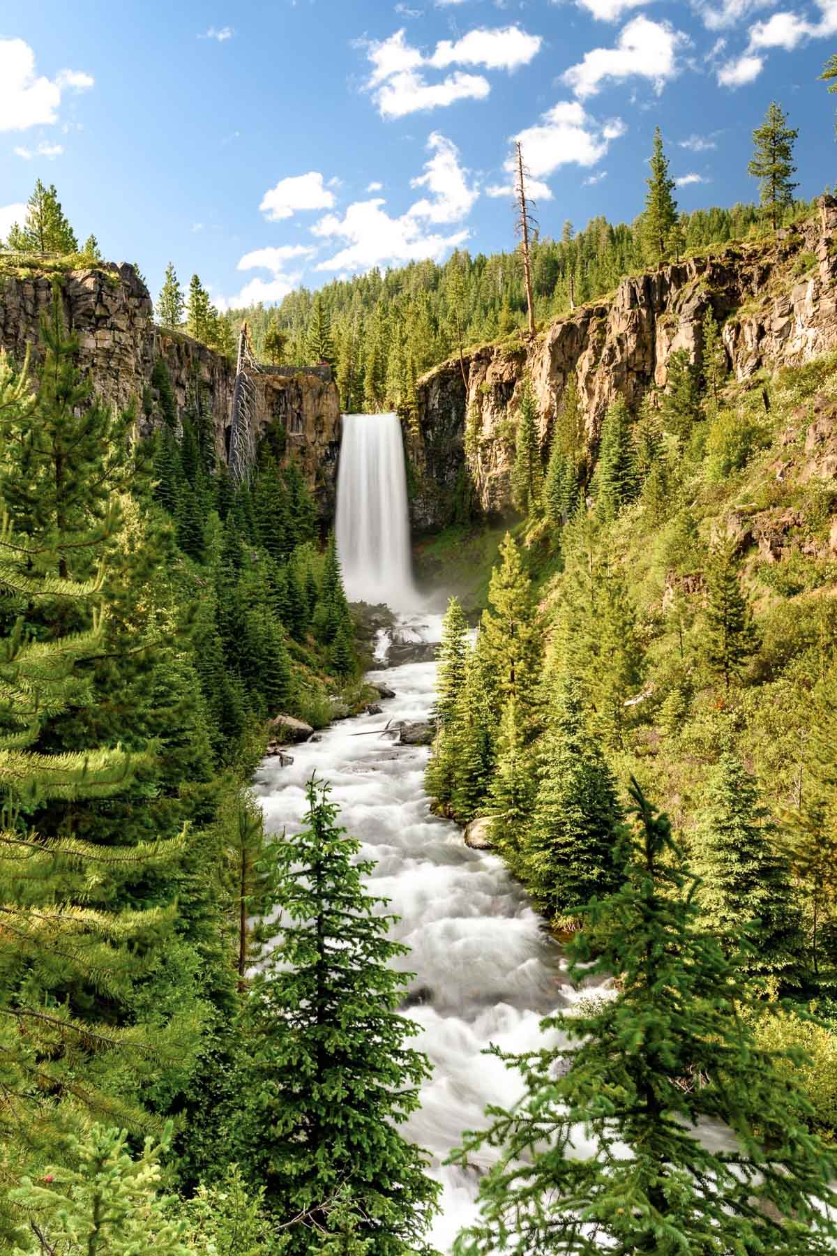
Tumalo Falls is a stunning 97 foot waterfall with a near vertical drop, making it one of the most iconic waterfalls in Central Oregon. With a number of accessible viewpoints, hiking trails, and additional waterfalls, this is a great place to explore if you’re visiting Bend and want to spend a day outdoors!
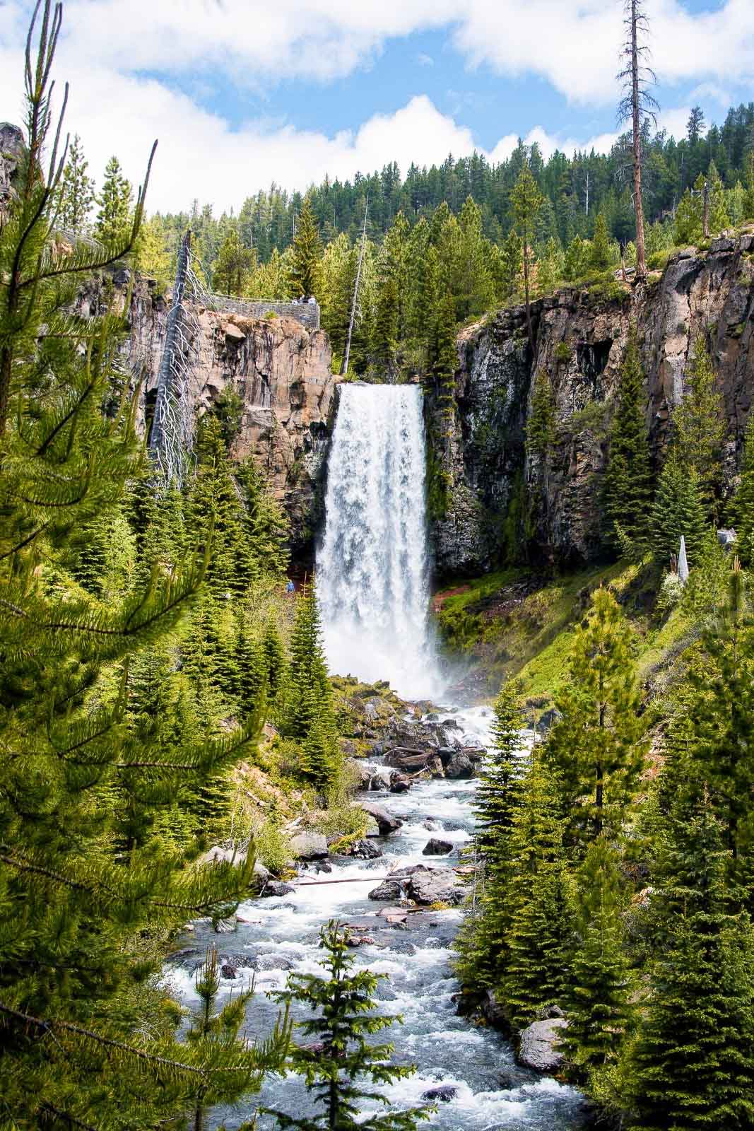
Located in the Deschutes National Forest just outside of Bend, Oregon, Tumalo Falls is one of our favorite local outdoor adventures. At nearly 100 feet, this glacial fed waterfall thunders down into a valley filled with lodgepole and ponderosa pines, hemlock, and dotted with stands of quaking aspen.
It’s close proximity to town makes this an excellent half day trip. In the post below we share all the details you need in order to visit and hike Tumalo Falls!
How to get there
Tumalo Falls is located 13.5 miles west of Bend, OR. To get driving directions, look up “Tumalo Falls Trailhead” on Google Maps, which will lead you to the trailhead parking lot. Note that Tumalo Falls is NOT in Tumalo State Park.
The last 3 miles are on an unpaved gravel road. You don’t need a high clearance 4×4 vehicle, but you’ll want to take it slow. During the winter months, this part of the road is closed by a gate and you’ll need to walk it.
It’s also important to know that there is a 27 foot vehicle limit for the parking area.
Permits & fees
There is a $5 parking day use fee, which you can buy online here or at the trailhead (bring exact cash). Alternatively, if you have an annual NW Forest Pass or National Parks/Interagency Pass, you can use either of those. No other hiking permits are required.
Best time to visit
Summer & early fall are the best times to visit Tumalo Falls if you want to hike or just take in the falls from the viewpoints. This is a very popular trail and the parking lot is on the small side, so it’s best to get there early in the day or visit mid-week if you can.
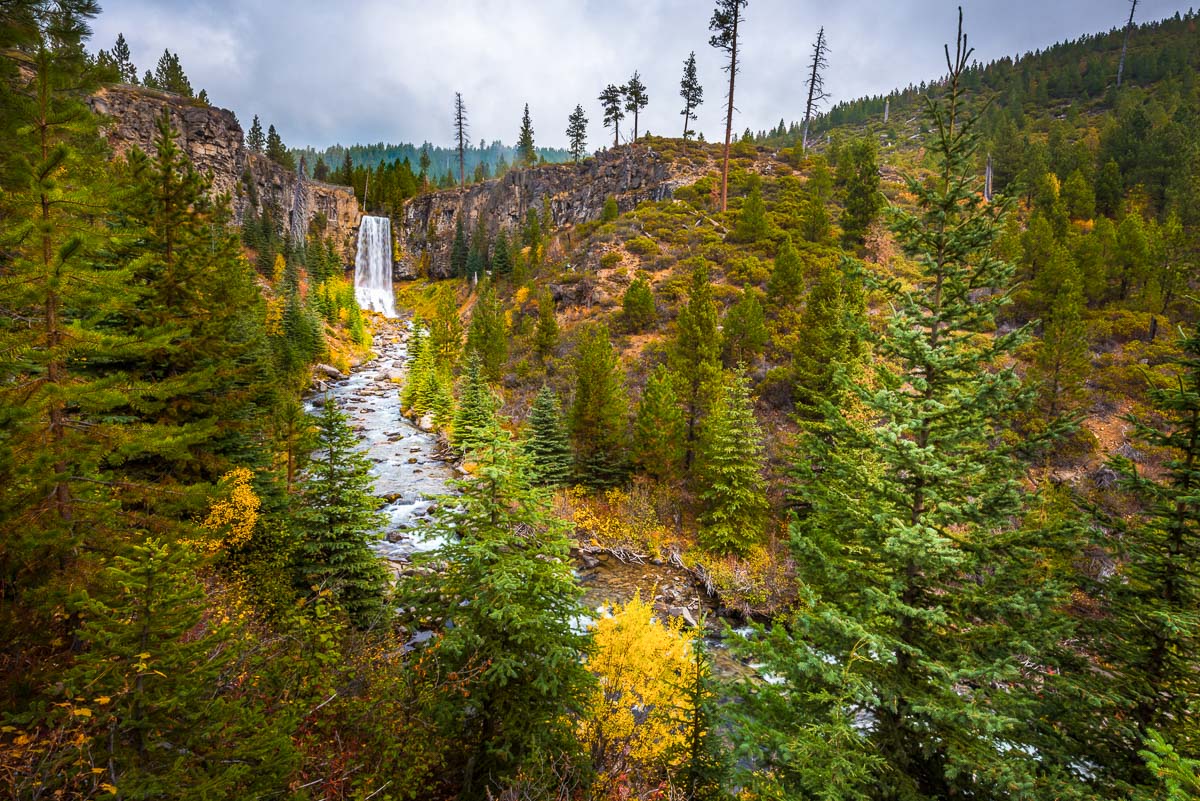
Winter & spring are also stunning times to visit the falls when it’s much less crowded if you’re prepared to hike in the snow and have appropriate winter hiking gear and footwear like snowshoes or microspikes. The gate on Tumalo Falls Road just passed the bridge is closed during the winter (usually until mid-June) so you’ll need to walk the last 3 mile (one way) section either on the road or along Tumalo Creek Trail.
What to bring
If you just want to see the falls and aren’t going to do any hiking, you’ll just need to bring water, sturdy shoes, a camera, and perhaps a picnic lunch to enjoy at the picnic area.
If you’re going to do any of the longer hikes, be sure to bring the basic hiking essentials including extra water, sturdy hiking shoes, a map, sun protection, and plenty of hiking snacks!
Tumalo Falls hikes & viewpoints
There are a number of trails that you can hike that start at the Tumalo Falls trailhead! Here are short descriptions of each.
Tumalo Falls Lower Viewpoint
Just a short distance from the parking lot, you’ll find the lower viewpoint, making this a great option for those who just want to see the falls or are unable to go on a longer hike.
Tumalo Falls Upper Viewpoint
- Distance: ½ mile round trip
- Elevation: 115 ft
- Rating: Easy
This short trail will bring you to a viewpoint that looks out over the top of Tumalo Falls and down to Tumalo Creek flowing through the valley.
Tumalo Falls to Double Falls
- Distance: 2 miles out & back
- Elevation: 320 ft
- Rating: Easy
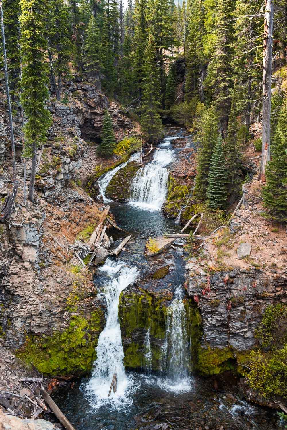
Once you hit the upper viewpoint, you can continue on along the North Fork Trail to reach Double Falls, a pretty two-tiered waterfall that can be viewed from the trail.
Upper Tumalo Falls
- Distance: 4.6 miles out & back
- Elevation: 764 ft
- Rating: Easy
To extend your hike, you can pass Double Falls and keep hiking on the North Fork Trail along the river through the lodgepole pines to Upper Tumalo Falls.
Tumalo Falls Loop
- Distance: 6.8 miles
- Elevation: 1,260 ft
- Rating: Moderate
The Tumalo Falls Loop is a perfect half day hike that will take you along the North Fork and Swampy Lakes trails and gives you a chance to see all the waterfalls in the area.
Follow the North Fork Trail past the viewpoints, generally following Tumalo Creek, for about 3 ¼ miles until you reach the junction with Swampy Lakes Trail #23, where you will turn left.
A little ways past this junction there will be a river crossing—there are usually a number of fallen trees that you can use to cross, but use caution when doing so.
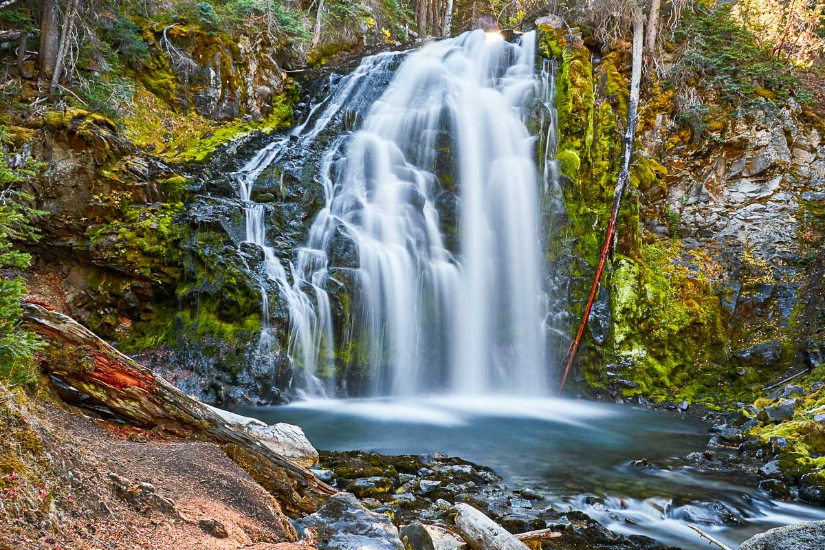
After hiking along Swampy Creek Trail for about 2 ½ miles, you’ll come to a junction with Bridge Creek Trail #24—take a left to turn onto Bridge Creek Trail, where you’ll pass Bridge Creek Falls before returning to the trailhead parking lot.
It’s important to note that dogs are not allowed on this particular loop because the second half crosses into the City of Bend Watershed. You can see the boundary on this map.
North Fork Flagline Loop
- Distance: 9.5 miles
- Elevation: 1,430 ft
- Rating: Hard
This is a more challenging loop that will take you along Tumalo Creek and provides views of the Cascades.
From the viewpoint, continue walking along the North Fork Trail, following the creek and passing a few more waterfalls including Double Falls and Upper Tumalo Falls. When you reach the junction with Swampy Lakes Trail #23, turn right and walk for half a mile until you reach the junction with the Metolius-Windigo trail.
Take a right and walk just over a mile to the 370/4601 Trailhead junction with the hang a right to connect with the Mrazek/Flagline Trail for 1 ½ miles.
Once you hit the junction with the Farewell Trail #26, take a right and begin your descent back into the valley to connect back to the trailhead. You’ll exit the trail on the other side of the river and you’ll need to walk across the bridge to get back to the parking lot.
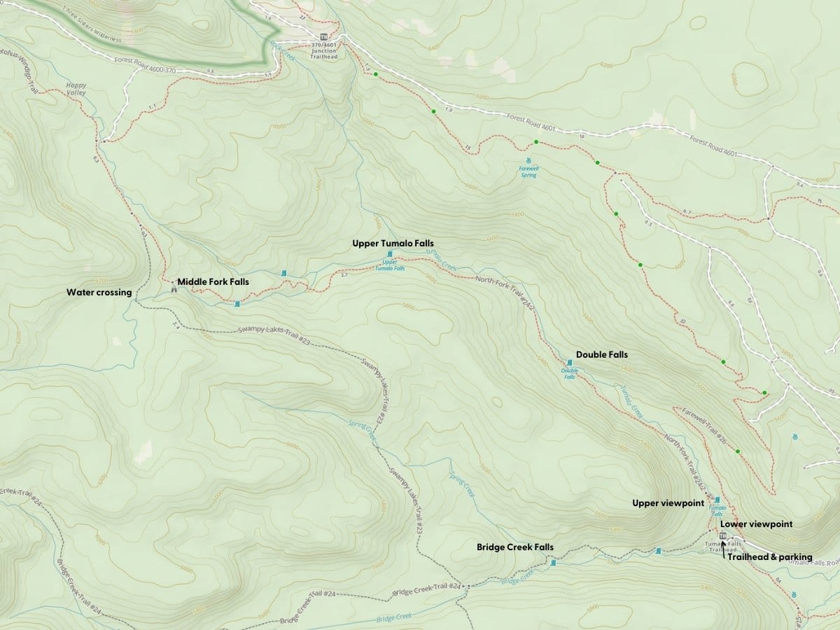
Trail map
You can access this map by clicking here! If you’re on a mobile device it will work best if you have the GAIA GPS app (free, but the paid version will give you offline access. Save 20% on your subscription here).
Check out this next post for more of the best hikes near Bend!