The Best Outdoor Hidden Gems of St. George, UT
This post may contain affiliate links.

While everyone is familiar with Zion National Park, few people realize that the nearby region of St. George is a hiker’s paradise that’s not to be skipped! In this post, we share our favorite St. George hikes, including beautiful hiking trails in Snow Canyon State Park, Yant Flat, the Vortex, and Red Cliffs Desert Reserve.
We partnered with the St. George Tourism Board to uncover some of the best “off the beaten path” outdoor destinations in southern Utah.
From red rock formations to vermillion sand dunes to warm water swimming holes, we spent a week seeking out some of the lesser-known outdoor attractions here.
Jump to: Snow Canyon State Park | Petroglyph Hike | Diamond Cinder Cone | The Vortex | Sand Hollow State Park | Red Cliffs Desert Reserve | Yant Flat | Maps And Resources

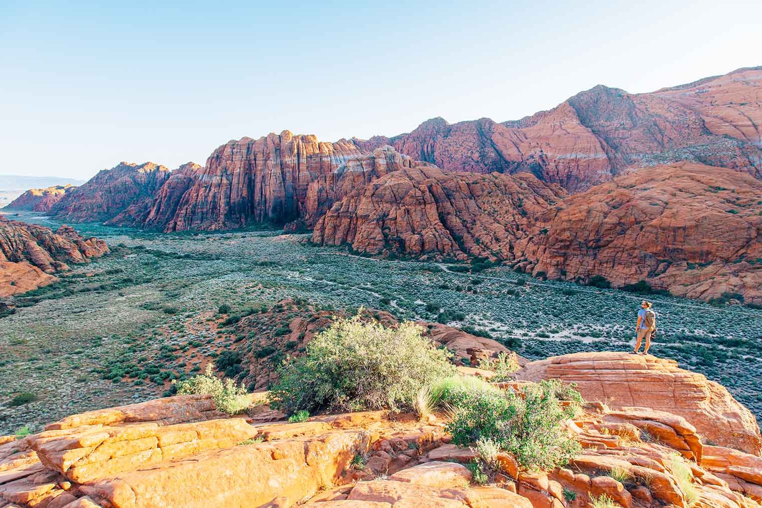
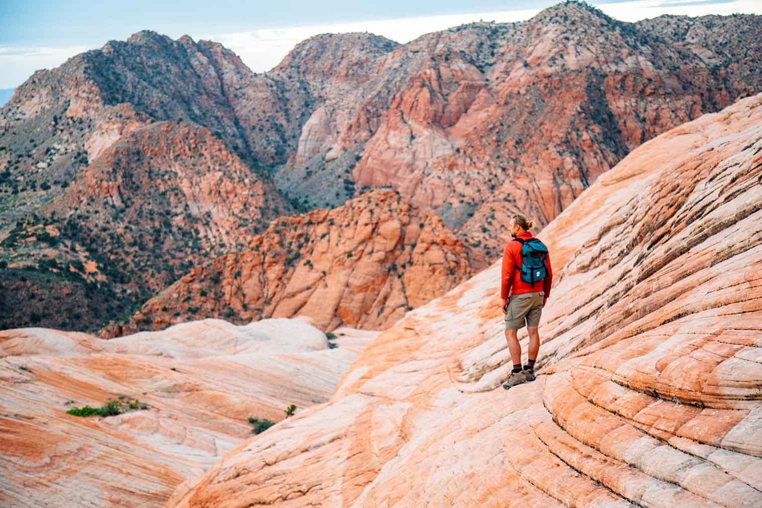
Snow Canyon State Park
Located just 15 minutes north of St. George, Snow Canyon State Park has been likened to a “mini-Zion,” and for good reason! This park was absolutely stunning. In fact, it has been said that if Zion wasn’t so close, Snow Canyon would have easily been a designated a National Park.
This spectacular 7,400-acre park is tucked away amidst towering red and white sandstone cliffs, ancient lava fields, and vermillion sand dunes. With over 38 miles of hiking, a three-mile paved bike path, 15 miles of equestrian trails, and over 180 climbing routes, there are plenty of ways to experience this magnificent desert park. A map of the park can be found here.
We spent two nights at the Snow Canyon campground, which has 27 sites (15 with hookups and 12 tent camping), hot water showers, and flush bathrooms. There is also a day-use picnic area. While the campground was full while we were there, the sites are spaced apart so nicely that we hardly knew anybody else was around. Make your reservation online here.
Pro Tip: Try to reserve campsite #26 – is it the most secluded site in the entire campground.
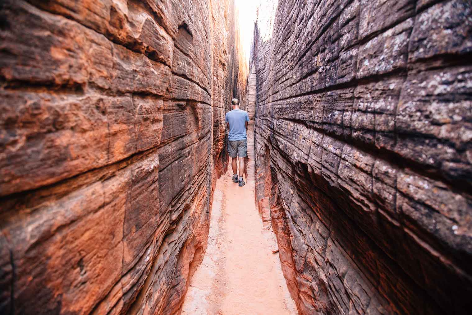
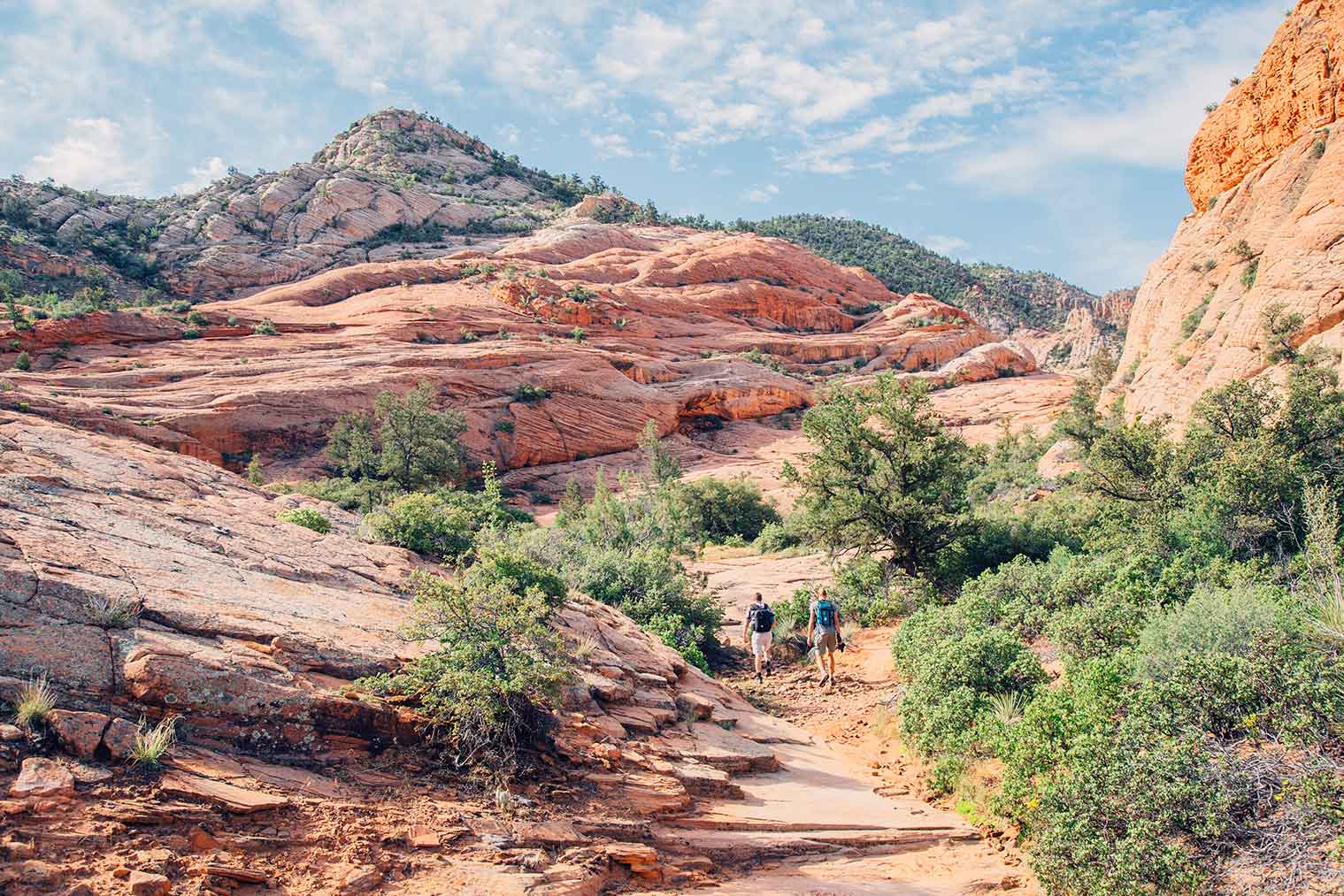
Petroglyph Hike
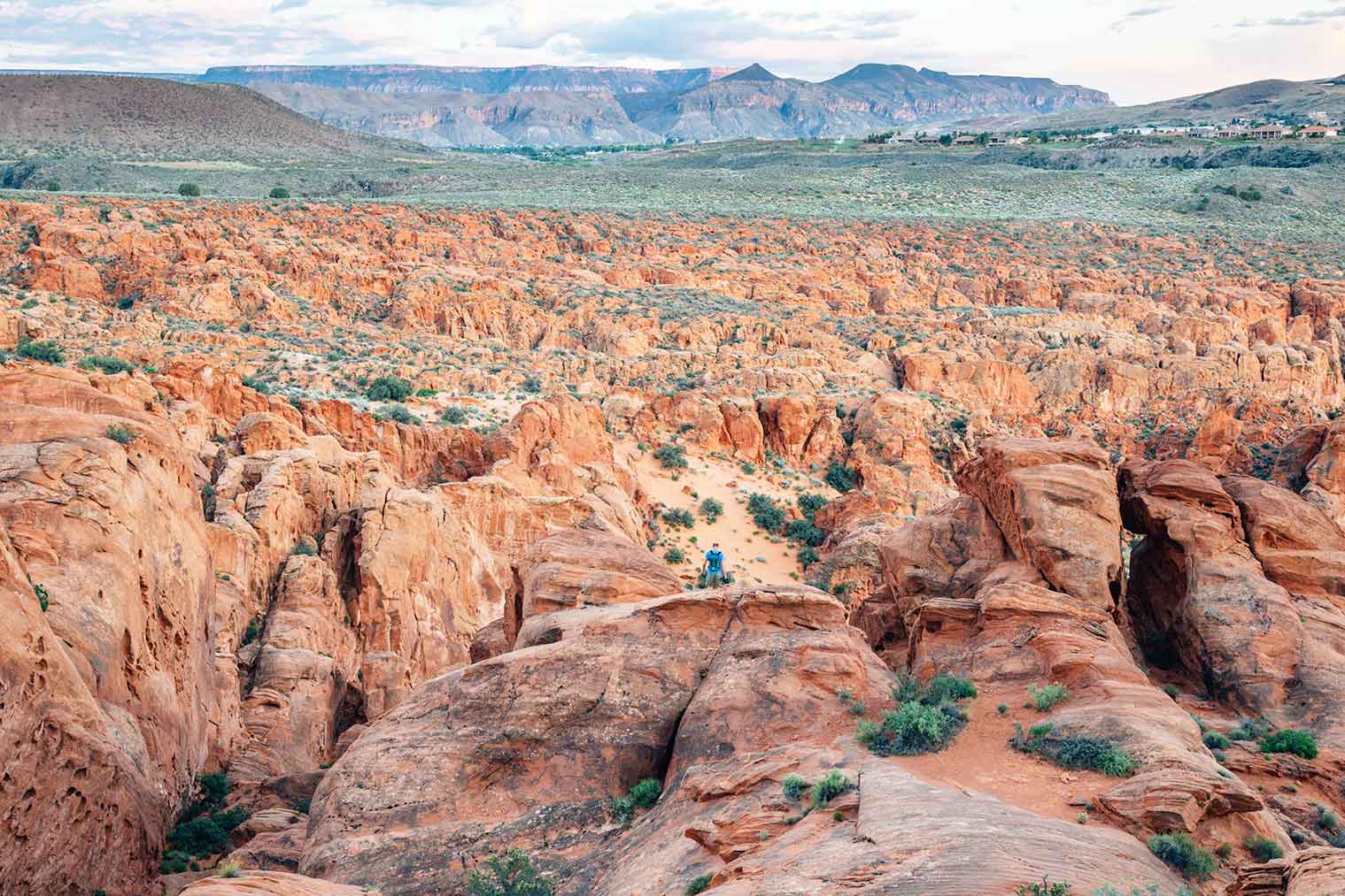
Looking for a hike off the beaten path? Try the petroglyph loop, in a secret slot canyon, located off of the Gila Trail.
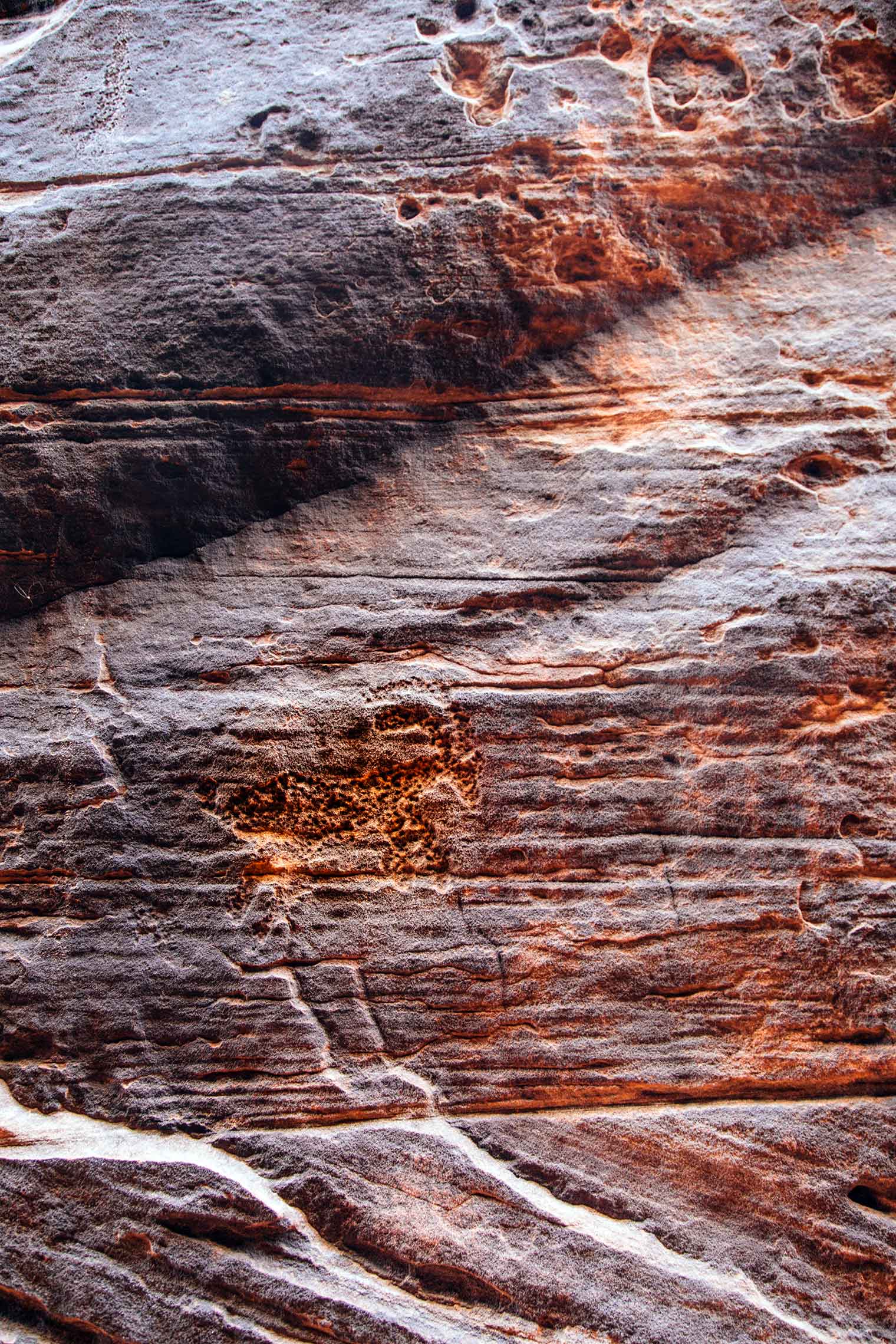
The moderate 2.5 mile trail (one-way) leads out into a maze of red rock formations that requires hikers to do a little light scrambling in some sections. The entrance to the slot canyon is shaded by vegetation and extremely easy to miss, but once you’ve found it, you’ll know. The straight walls narrow to about shoulder width and look like something straight out of Indiana Jones. Follow the canyon to the end and look to your right. The blackened wall is covered with ancient petroglyphs, carved by hand, by the native people who once inhabited this land.
We implore you, treat this area with respect and leave no trace.
Getting to visit this site was a truly spectacular experience. For more information, check with park staff at the visitor center.
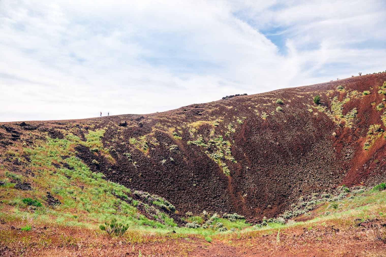
Diamond Cinder Cone Hike
This hike leads up one of the many ancient volcanoes that helped shape the landscape of the area.
While technically within Snow Canyon State Park, this hike requires you to leave the main canyon and drive north along route 18. There you’ll find a pull-off along the side of the road that doubles as a parking lot.
The main trail loops around the back of the cinder cone and briefly passes through private property. There will be a two latched gates you’ll have to pass through, just make sure you close them behind you. The crumbly gravel trail then ascends straight up the side of the hill, so make sure you’re wearing proper hiking shoes. (We saw some unhappy hikers attempting it in flip-flops. It was not pretty…)
At the top, there’s a trail that circles around the rim of the volcano. If you look to the north, you can see another cinder cone rising from the valley floor. On the low side of the rim, there is another trail that leads down into the long-since extinct crater. This was a perfect short hike that gave us some perspective on how the surrounding landscape was formed.
For more information about the hike, including a trail map, check out Summit Post’s trail report about it.
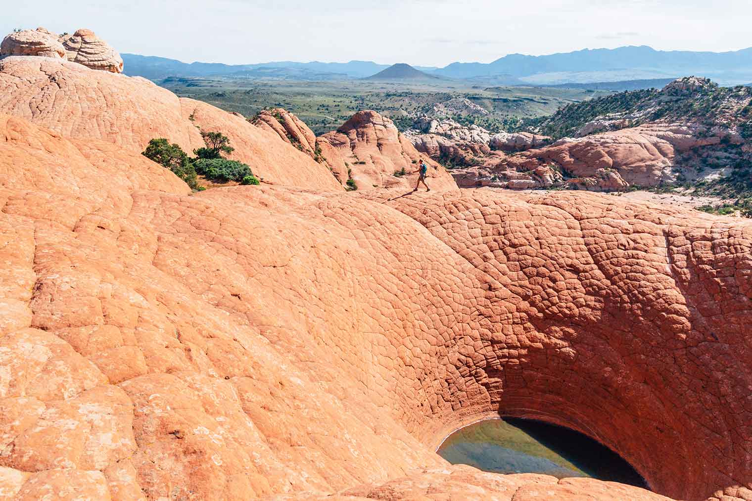
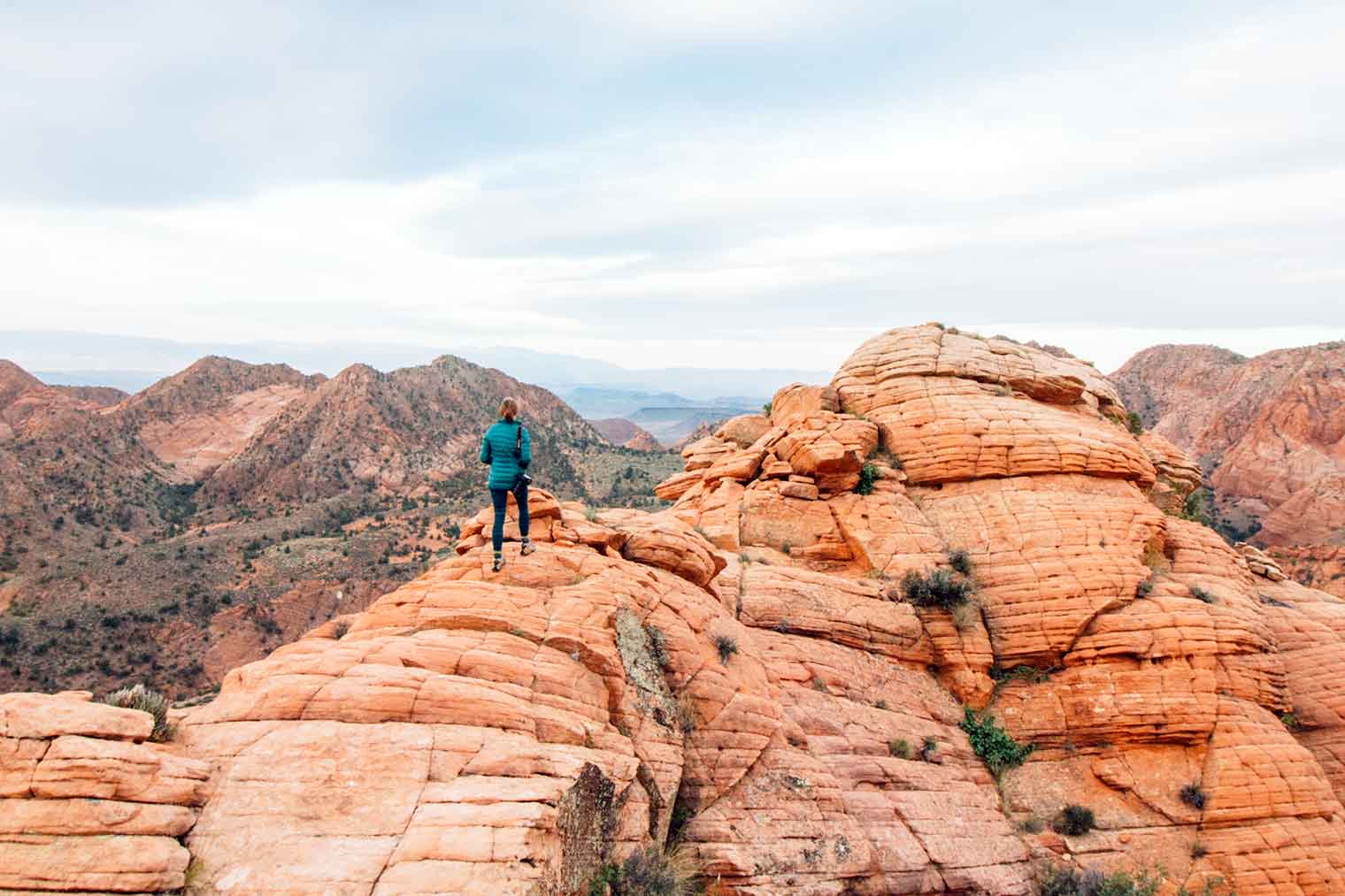
The Bowl aka The Vortex
If you are looking to experience some gorgeous southern Utah landscape, but don’t want to pay a park entrance fee, then we’d absolutely recommend this hike to The Bowl (also referred to as The Vortex).
This hike is located on BLM (Bureau of Land Management) land, which is open to public use. (If you’re interested in camping on BLM land nearby, check out our article about how to find free camping.)
This 2.5 mile moderate hike steadily climbs sloping red sandstone rocks that thousands of years of erosion have carved into what appears to be a natural staircase. The trail hooks right onto a sandstone rise, which reveals The Bowl. We are still unclear what geological force caused this giant depression in the earth, but it made for a great payoff at the end of our hike.
For more information about the hike, including a trail map, check out Hike St. George’s trail report about it.
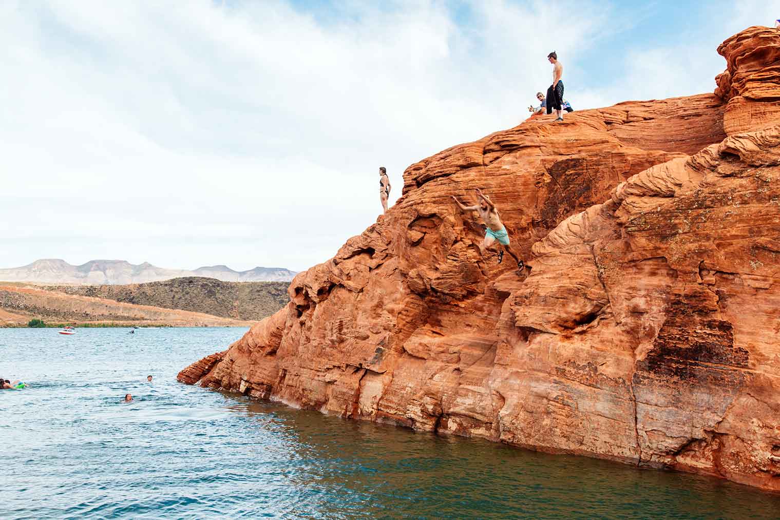
Sand Hollow State Park
Southern Utah can get hot in the summer, which is why you should beat the heat at Sand Hollow State Park.
Just 15 minutes east of St. George, this warm water reservoir combines clear blue water with red sandstone cliffs to create the perfect watersport escape.
This sprawling 20,000-acre park offers a variety of water activities like paddleboarding, kayaking, wakeboarding, and even scuba diving. The reservoir contains a sunken airplane and bus for divers to explore! There are also a variety of OHV trails in the park that can be explored via ATV or dirt bike. Rentals are available on site.
But what really took the cake for us, was the cliff jumping. Towards the far north end of the parking lot, past the boat launch, the red sandstone cliffs come right up to the water’s edge. Park your car here and make your way on foot along the coast. You’ll eventually come to spot where the cliffs rise up to about 50 feet and drop down into the deep blue water.
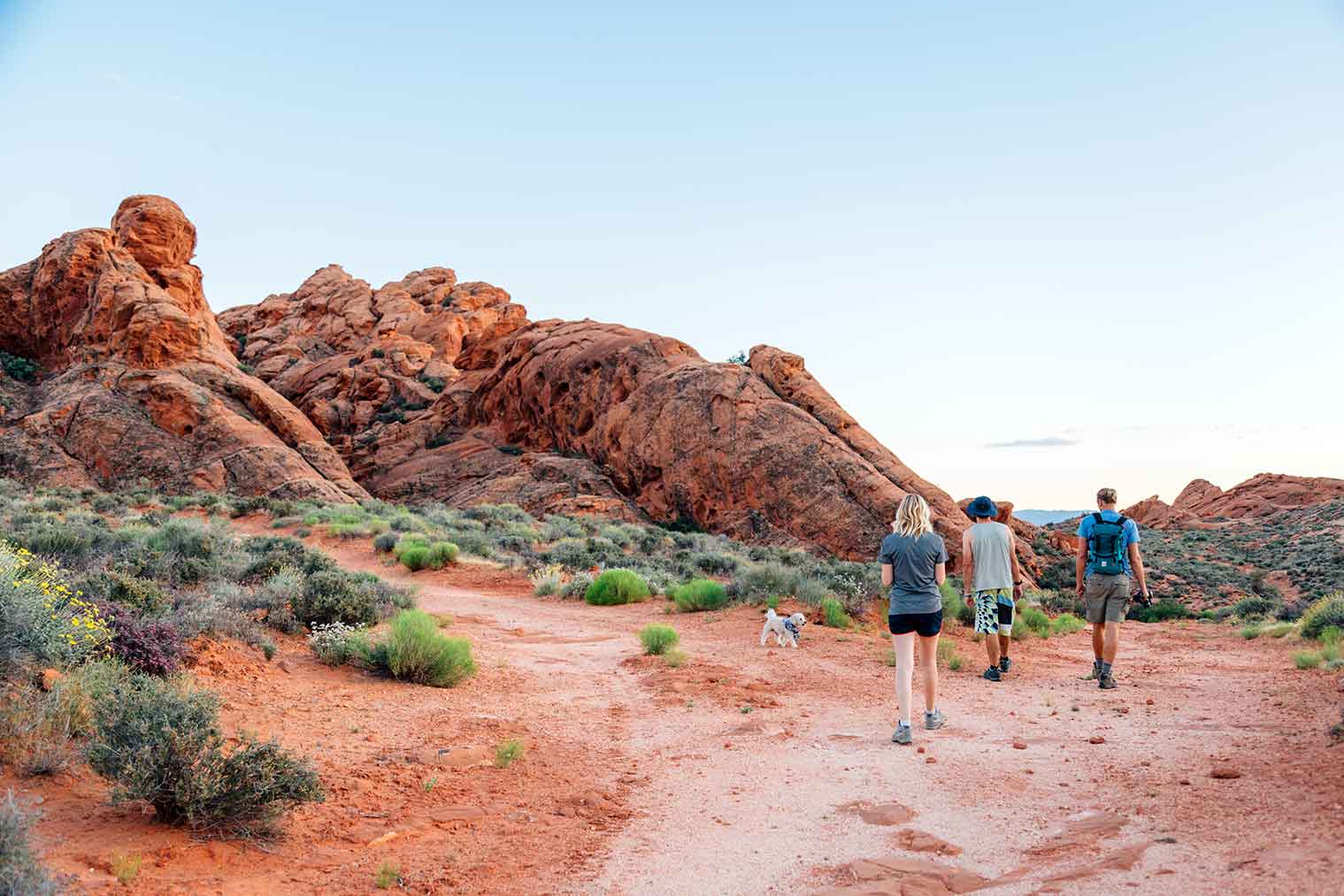
Babylon Arch Trail – Red Cliffs Desert Reserve
This short 1.5 mile hike offers some spectacular red rock vistas. We did a sunset hike here with our friends Ali and Tyler, who were in town visiting Zion. While we weren’t able to find the arch before the sun went down, we had a great time exploring the red Martian landscape.
For more information about this hike, including a trail map, check out Hike St. George’s trail report about it.
Yant Flat – Dixie National Forest
Perhaps you’ve heard of The Wave in Arizona. Well, Yant Flat is Utah’s equivalent. While it might not be quite as spectacular as The Wave, Yant Flat doesn’t require you to enter into a permit lottery system. In fact, you don’t need any permits at all to visit it!
The short 1.3 mile hike leads out into a field of swirling red and white sandstone. Once the trail officially ends, you are free to scramble over the eroded cliffs, buttes, and ravines.
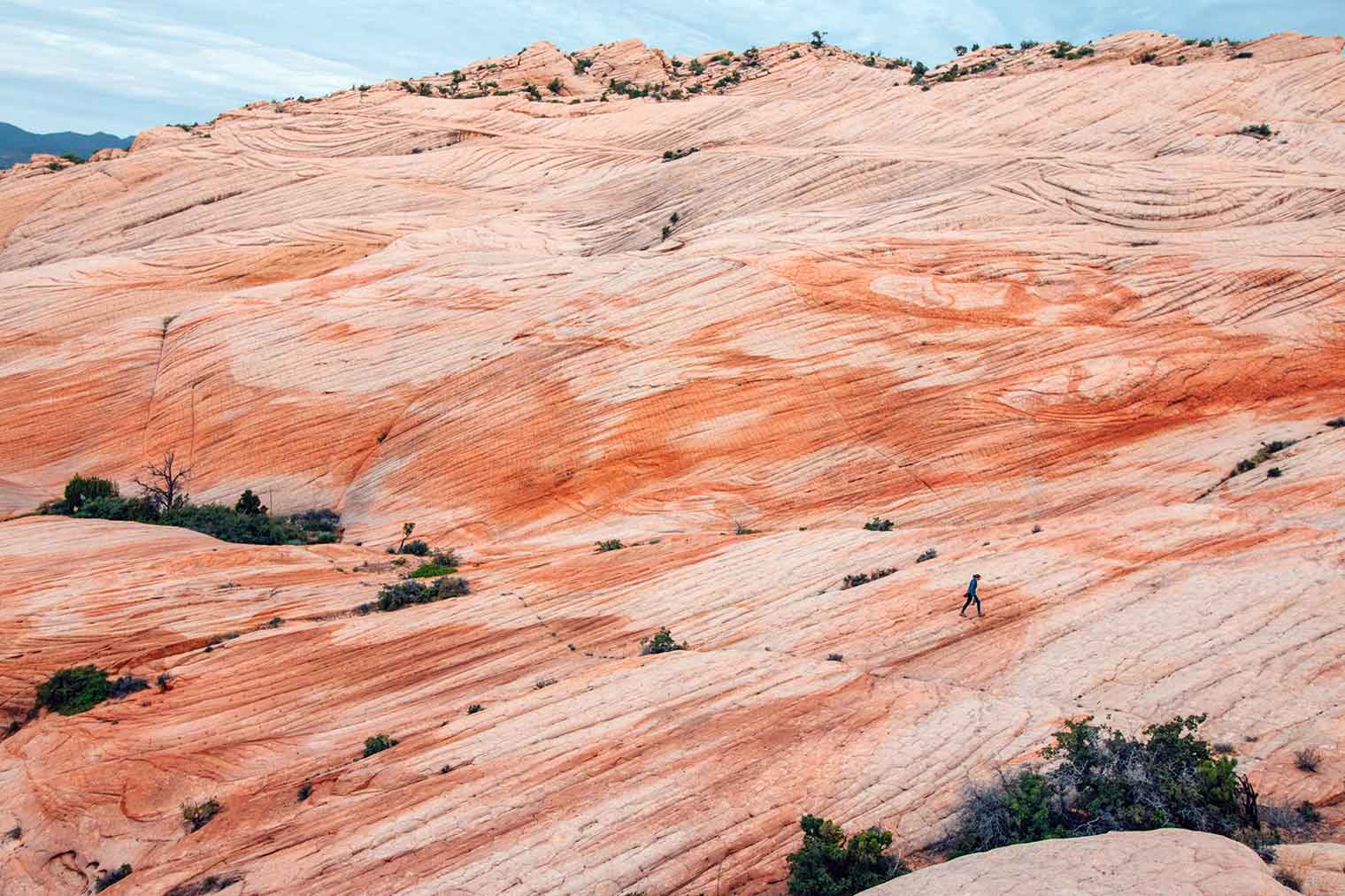
We camped in the Dixie National Forest and did this hike to catch the sunrise. The early morning light really brought out the color of the rocks, but we suspect sunset would do the same thing. As people who thought geology was boring in high school, this place completely changed our minds. We’ve never seen such interesting and varied rock formation in our lives.
For more information about this trail, check out this trail report on The American Southwest.
Final Thoughts
If you’re planning a trip out to St. George, we’d definitely suggest checking out a few of these amazing destinations. We guarantee you could spend an entire week out here without a visit to Zion and never get bored. Also, if you are crowd-averse (like we tend to be) these hidden gems offer a wonderful alternative to experience the southern Utah landscape.
Maps and Resources
NatGeo Map St. George: If you are heading to the St. George area, this trails map by NatGeo can be a great resource. It shows National Forest boundaries, hiking trails, drinking water, dump stations, and campgrounds with showers, and loads of other useful information.
Benchmark Utah Atlas: If you are planning on visiting a couple places in Utah, it might be worthwhile to pick up this Benchmark Map. Not only do they outline National Forests, BLM and other land agencies, but they’re filled with other helpful information like campgrounds, topography, drivable roads (by classification), trailheads, water sources, and much more.
HikeStGeorge.com: This is a great online resource for hiking in and around the St. George area. Trails can be filtered by length and by difficulty. Find a trail that’s right for you!
VisitStGeorge.com: The Visit St. George website has a ton of great information about hiking and outdoor recreation areas. Check out their blog, which is written by Mike Carr, who was our guide during our stay here. He has a ton of great insider information about unique and interesting places to explore in the area.
If you’re planning a trip to the St. George area, you’ll probably also want to check out Zion National Park! While you’re there, we definitely recommend hiking the Narrows, checking out some of the lesser-known hikes in Zion, and booking a canyoneering trip with the Zion Adventure Company!
Wow these pictures are absolutely stunning! I especially loved that close up of the rock face. As a rock climber, that’s one of the most beautiful images to me! 🙂
Good info! I’ll have to visit some of those places when I’m back through, especially the swimming hole. It’s hot as h*** today in AZ, and I really could use a cool dip.
Love this guide, you guys! I’m a huge fan of St. George and love that this city has so much to offer beyond the large National Park. Zion is gorgeous and so fun but adding all these extra adventures is what will make any Zion trip that much better.
Nice info. I’m in St George now and will try to find the Petroglyphs & Vortex tomorrow. I’m really bad on directions but will try.
Cheers
– Michael
Cambridge, MA
Hi Michael – Hope you had a wonderful trip to St. George and that it wasn’t too hot to go out and do some exploring! Did you manage to find the petroglyphs?
This is really well written. My photo-buddies and I use St George as a base to explore southern Utah. Who knew we were missing so much?!?!? I swear this is like a 15 min drive from where we stay. I am always looking for new (and especially uncrowded) places to do photography.
Looking forward to doing a couple of sunrises and perhaps a sunset or two here in November. I’ll try to reload that link for the slot cyn with the petroglyphs in Snow Canyon (not able to so now). Thanks for this write up, Ernogy
Very glad to read your travel experience to St.George in utah. Hope you had a great travel.
Really Amazing pictures, i really like it, i wish i go there in future.