Plan an Epic 7 Wonders of Oregon Road Trip
This post may contain affiliate links.
This is the ultimate Oregon road trip! Featuring seven of the state’s most iconic landmarks, this road trip itinerary is your guide to exploring the great state of Oregon.
Sponsored by Toyota
Oregon is home to some of the most beautiful and diverse natural landscapes in the country. Arid high desert, towering mountain peaks, winding rivers, lush forests, and pristine coastline, there are so many different and unique parts of the state to explore.
To give people a framework, Travel Oregon came up with The 7 Wonders of Oregon. These seven areas represent the most incredible scenic features the state has to offer. If you are planning on visiting Oregon, these locations should be at the top of your “must-see” list.
What follows is our ultimate road trip guide to exploring the Seven Wonders of Oregon. We’ve researched all the hikes, campgrounds, food trucks, and coffee shops so you can hit the ground running. Think of it as an “Oregon’s Greatest Hits” album!
So if you want to experience a road trip adventure of a lifetime, or just explore a few of the most iconic locations included, this guide is for you!
What Are the Seven Wonders of Oregon?
While the Seven Wonders of Oregon have no particular order, below is the order in which we visited them:
- Smith Rock State Park
- Painted Hills
- Wallowa Mountains
- Mount Hood
- Columbia River Gorge
- The Oregon Coast
- Crater Lake National Park

How to plan a Seven Wonders of Oregon Road Trip
Oregon is one of the best states to road trip in. There are so many scenic byways, small towns, and unique points of interest, you really want to be able to explore them at your own pace.
Ever since moving to Oregon, we’ve been talking about doing a road trip to connect all seven of the wonders. While we’ve seen a few of them in isolation, we really wanted the continuity of seeing them all together. The impact of one, building off the last.
We did this road trip in late-May of 2021 and it took us just under two weeks. We live in Bend, so our trip started and ended there and is reflected in the itinerary.
If you’re coming in from out of state, you can fly into the Redmond Airport (RDM) just outside of Bend and follow the order of this itinerary as written. Or, you can fly into Portland (PDX) and start from there!
If you live in Oregon, you can start with whichever 7 Wonder is closest to you and then follow the itinerary.
The loop can be done clockwise or counterclockwise—we started counterclockwise from Bend to save Crater Lake for last!

What is the best time of year for an Oregon road trip?
Early Fall
September is the ideal month to visit Oregon. The mountains will be clear of snow, the coast will be mostly sunny, and temperatures will start to dip in the desert. The crowds at many of these destinations will also taper off after Labor Day, although some restaurants and attractions in the mountains might start to close or reduce hours.
Summer
Summer is when most people visit Oregon. The weather in the mountains and along the coast is usually gorgeous. However, they will also be as crowded as they ever get. The one downside to summer is that sections of the high desert in central Oregon can get very hot.
Late Spring
Spring in Oregon—which lasts until mid-June—can be a real wild card. While there will be fewer crowds, the weather can be very unpredictable and you will want to prepare for a wide range of conditions. Additionally, the lingering snowpack from winter can limit activities in the mountains, with many campgrounds not fully opening up until late June or early July.
How long do you need?
We would say that the minimum amount of time to properly experience all 7 Wonders of Oregon is about 10 days. Of course, the more time the better, but 10 days will give you an accelerated yet well-rounded experience.
While many of the destinations warrant anywhere between 1-2 days to visit, the section that could really be enhanced with more time is the Oregon Coast.
With 363 miles of coastline, dozens of towns, and thousands of unique attractions, you could spend an entire two weeks on the coast alone and not get bored!
So if the confines of your trip are going to force you to make cuts elsewhere, our recommendation would be: don’t shortchange the coast!
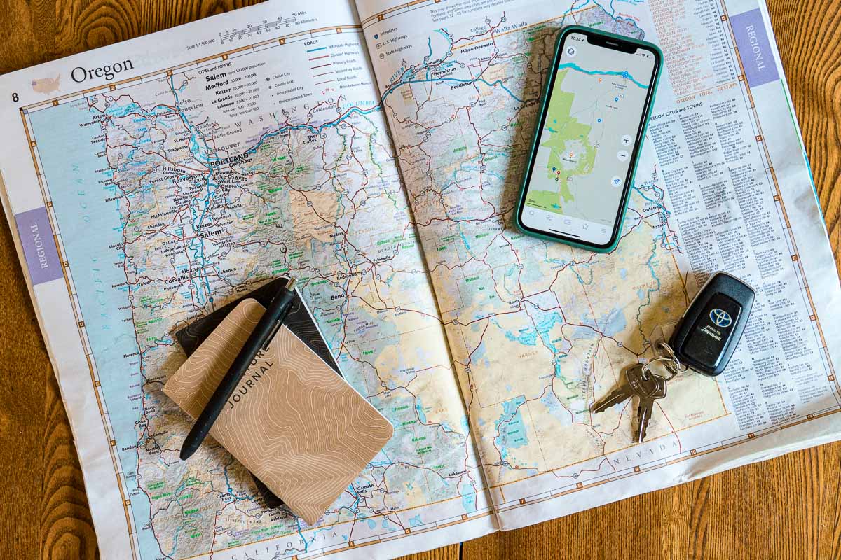
Booking and planning your trip
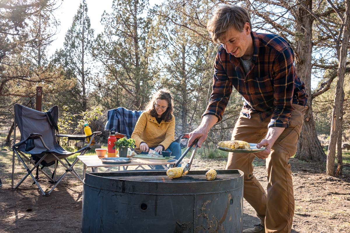
Not only does Oregon have some of the most spectacular landscapes, but it has some of the best camping in the entire country. If you are planning on visiting, we highly recommend doing at least some camping on your road trip.
For our trip, we mostly car camped. However, we did make use of some strategic Airbnbs and hotels. Here are some great resources to help you plan your trip.
Accommodations
While there are a lot of camping options, the most popular ones will often be booked up by late spring, so it’s important to make reservations in advance.
The Dyrt: This is a super intuitive app/website that we use to research campgrounds.
Recreation.gov / Reserve America: These are the two websites that will allow you to actually make your campground reservations. However, we find them to be a little clunky for research.
Campsite Photos: This is a website that has thousands of photographs of individual campsites, which we will reference before booking a site. This way we can “see” what the campsite will look like before we show up.
Trip Planning
ODOT Trip Check: This website is invaluable for checking driving conditions in the mountains. Google and Waze don’t report snow conditions and will happily direct you into a blizzard. So if you’re going to be doing any driving during spring, winter, or fall, do a quick Trip Check before you depart. It also has the most accurate info about DOT road work.
InciWeb: Wildfires have become increasingly common, and, tragically, are no longer contained to the typical “wildfire season” of late summer. This website will allow you to check if there are any active burns and see the affected areas.
USDA Forest Service Snow Depth: This website will allow you to view approximate snow levels throughout the state. This is really important for late-spring hiking when trails at higher elevations can remain under snow until mid-summer. [The map centers on the Sierras, but can be moved to Oregon]
AllTrails: This is our favorite app for hiking. It allows us to scout out potential trails ahead of time, provides GPS tracking, and allows us to record our tracks.
National Parks Pass & State Park Pass
We would highly recommend buying a National Parks America The Beautiful pass as well as an Oregon State Park Pass before your trip.
National Parks Pass
The entry fee for Crater Lake National Park is $30 per vehicle. You can buy a pass at the park entrance. However, you may want to consider purchasing an America the Beautiful Annual Pass for $80, which will also cover you for the many National Forest trailheads located throughout the state.
Northwest Forest Pass
If you already own or plan on purchasing an America the Beautiful pass (aka the national parks pass), this Northwest Forest pass won’t be necessary. However, trailhead parking in the national forests is generally $5 per day. The issue is that there often isn’t a way to pay at the trailhead—you have to go to the area’s ranger station (which is not necessarily close by!) To avoid having to track down day passes, you can buy day passes ahead of time, or you can buy a Northwest Forest Pass for $30.
State Parks Pass
Many of Oregon’s state parks charge a $5 daily entrance fee (see the full list), including places like Smith Rock as well as many locations along the Columbia River Gorge and the Coast. Depending on your itinerary, it may be more economical to buy an annual pass for $30.
A word about Oregon’s full-service gas stations
Oregon is one of two states in the US, where you are not allowed to pump your own gas (the other being New Jersey). A gas station attendant will do it for you. If you are coming from out of state, this might feel uncomfortable at first, but we promise, by the end of your trip, you’ll come to love the full-service experience.
Just sit in your car, roll down your window, and pop the gas tank, and the attendant will take it from there. You can get out of your car to wash your windshield or go to the restroom, just don’t try to operate the pump.
Exceptions: Oregon recently passed a statute that allows for self-pumping in some of the less populated counties under certain restrictions. You can see where you can and can’t pump your own gas by checking out this map here.
Is tipping expected?
No. There is no expectation you should tip a gas attendant. That being said: if it’s 30 degrees, howling winds, and freezing rain outside, the attendant won’t refuse a couple extra buckets, but it’s absolutely not expected.
Diesel drivers: Be vocal!
If you are driving a diesel vehicle, understand you are the exception, and specify to the attendant you need diesel. Don’t just holler out the window: “Fill ‘er up!” We know of at least one disaster that resulted from a miscommunication like this. So just be clear and you’ll be fine.
Options for Plug-in Hybrid and Electric Vehicles
If you’re driving a plug-in hybrid like the Toyota Prius Prime, or an all-electric vehicle, there are a ton of charging stations throughout the state. In fact, many of Oregon’s scenic roads have now been classified as “Electric Byways” because of how easy it is to find charge stations along the route! On our road trip, since we were camping, we also found that we could charge the Toyota Prius Prime at many of our campsites as well.
Plan ahead, especially when traveling through the more remote areas of Central and Eastern Oregon, by using an app like PlugShare.
7 Wonders of Oregon Road Trip Itinerary

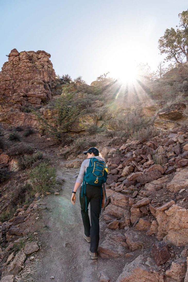
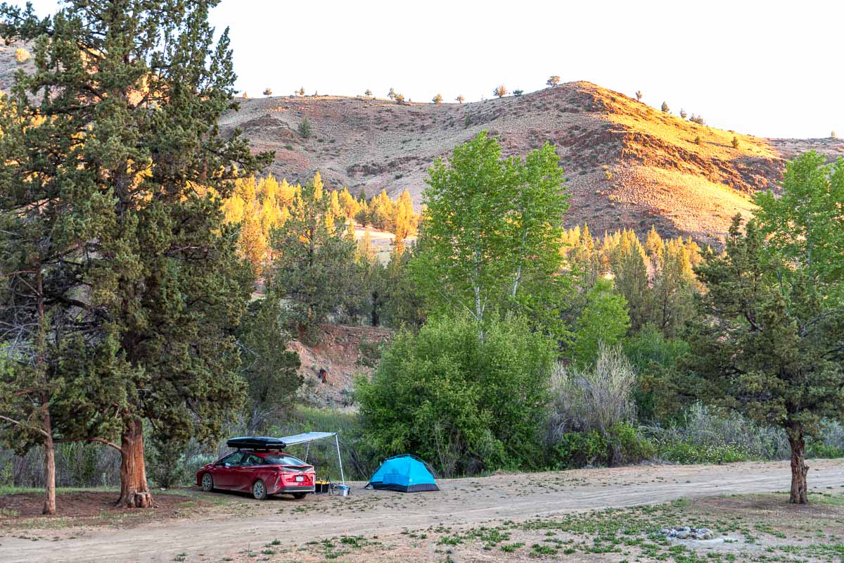
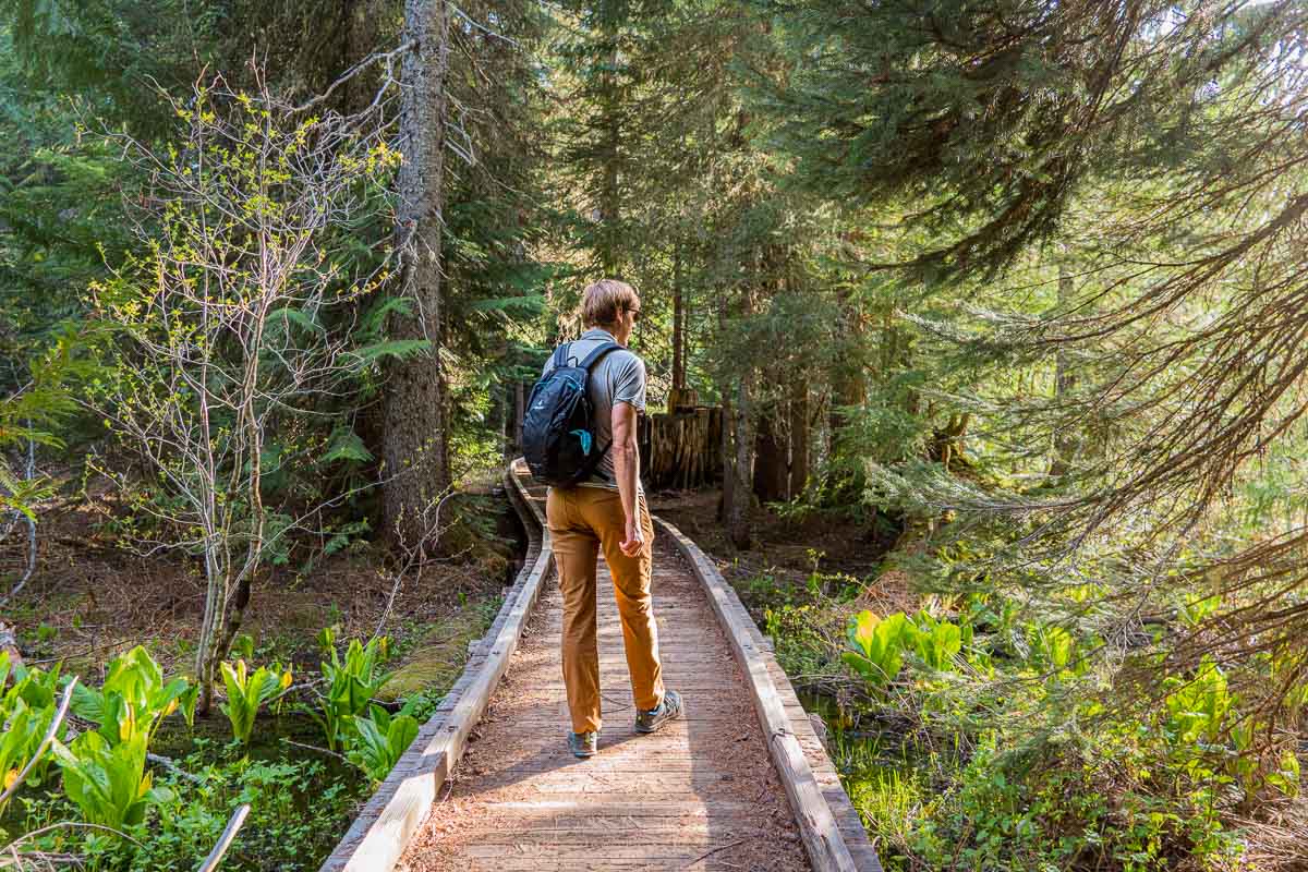
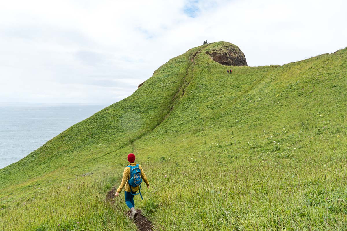
Smith Rock State Park
Towering rock spires, a winding river, and impressive basalt columns are just some of the many attractions of Smith Rock State Park.
Rising up out of the otherwise desolate high desert, Smith Rock is something of a geological wonder and gives testament to the region’s long history of volcanic activity.
The unique rock formations attract outdoor enthusiasts from all over the world, and has become a major destination for hikers, rock climbers, and mountain bikers.
Recommended Time: ½ – 1 Day
People looking to do a few casual hikes followed by a picnic will be able to experience Smith Rock and the surrounding attractions in about a day. However, if you’re a rock climber, you could easily spend the entire summer here (and many do!)
Know Before You Go:
- Oregon State Park Pass Required (or $5 day use permit)
- Day-use visitor hours are from dawn to dusk
- Dogs are allowed, but must remain on a leash at all times

What To Do at Smith Rock
Hiking
With over 650 acres and 12 official trails to explore, Smith Rock has a great hiking trail for every skill level. While you have the opportunity to gain a lot of elevation, there are also milder trails that are fantastic for trail running or hiking with kids.
Crooked River Loop (3.5 miles): This easy cruise around the crooked river is a very mellow trail that’s great for families. Post up along the river and watch rock climbers scaling the cliffs overhead.
Misery Ridge to River Loop (3.7 miles): This is a great introductory hike to Smith Rock. It starts off fast and steep before descending back down for an easy cruise around the river.
Misery Ridge & Summit Trail Loop (6 miles): This extended version of the above-mentioned trail takes you deeper into the park.
Rock climbing
Widely considered to be the birthplace of sport climbing in the US, Smith Rock is one of the premiere climbing destinations in the country. With close to 2000 routes, ranging from fourth class to 5.14, there’s a lot of options for every level of climber.
You can learn more about climbing at Smith Rock here.
Hot Air Balloon
Big Sky Balloon Company offers hot air balloon rides that offer stunning once-in-a-lifetime vistas of the central Oregon landscape. Flights are conducted at dawn, departing once a day from Smith Rock Ranch.
Places to Eat
Terrebonne Depot: This converted railway depot is situated on an active freight train line and serves up American-style cuisine.
Terrebonne Coffee Wagon: Conestoga Wagon themed drive-thru coffee shop.
Redpoint Climbers Supply: While Redpoint primarily serves as a climbing supply store, they also sell coffee and beer.
Where to Stay
Camping
The Bivey Area (tent camping only): This is the only camping allowed within the state park. It is first come, first serve. During the high season May-September, this campground is usually at maximum capacity.
Skull Hollow Campground: This is the closest campground to Smith Rock. It is also first-come, first-serve, but can accommodate car camping and RV campers. There are pit toilets and fire pits, but no potable water and you should bring your own firewood. More information at USDA Forest Service Skull Hollow Campground.
Airbnb
Smith Rock Casita: Ideally located just outside the park (like walk across the street close), Smith Rock Casita is by far the best Airbnb option if you are visiting Smith Rock. Book your stay here.
Additional resources

Getting from Smith Rock to the Painted Hills
Route: Take Route 370 to Prineville, then continue onto Route 26 up following signs for Mitchell.
- Prineville Coffee Company: A great place to grab a cup of coffee en route to Painted Hills.
- Creekside Food Court: A collection of food trucks around a central grassy lawn, this is a great place to stop for lunch and stretch your legs.

Painted Hills
The Painted Hills are one of the three units that comprise the John Day Fossil Beds. This otherworldly landscape features rolling hillsides that are stratified with stripes of red, tan, orange, and black, which reveal a sequence of past climate change. This area is a very popular spot for photography, especially around sunset.
Recommended Time: ½ – 1 Day
Prime time at the Painted Hills is late afternoon. That’s when the light really accentuates the colors of the hills. It’s also the most enjoyable time to hike. All of the hikes in the park are very short, you can easily do all of them in a ½ day.
Know Before You Go:
- Don’t Hurt the Dirt. It took millions of years to form. So stay on the marked trails!
- All of the hikes are very exposed, so don’t forget to bring sunscreen!
- The main hills are westward-facing, so they are best viewed at sunset.
- From spring to fall, potable water is available at picnic areas

What to do at the Painted Hills
Hikes
The Carroll Rim Trail (1.6 miles): The moderately trafficked out-and-back trail climbs to a panoramic vantage point high above the Painted Hills. It is definitely worth the trek up.
Painted Hills Overlook Trail (0.6 mile): This out-and-back trail is fairly level and follows along an old road.
The Painted Cove Trail (0.3 mile): The Painted Cove has an amazing color palette of vibrant rocks. A portion of this trail features a level boardwalk to cross over sensitive soils.
Red Scar Knoll Trail (0.25 mile): This mostly level trail leads to a hill of bright yellow and red clays. This trailhead is called Red Hill on the road signs.
Star Gazing
The Painted Hills are located in one of the few dark sky locations, making it an ideal location for stargazing. You can take a look at the Dark Sky Map here.
Visit Mitchell, Oregon
This is a tiny town with a lot of character. This former boom town perfectly captures the Old West, anything-goes aesthetic of eastern Oregon.
Painted Hills Scenic Bikeway
The Painted Hills Scenic Bikeway is one of Oregon’s many designated scenic bikeways. It covers 161 miles of central Oregon’s vast high desert terrain, winding rivers, and canyons.
Places to Eat
Tiger Town Brewing Company: Local brewery and restaurant that serves up small-batch beers with traditional brewpub fare.
Bridge Creek Cafe: A classic burger & fries joint.
Route 26 Espresso: Small drive-thru coffee kiosk. If you’re coming from out of state, you’ll be seeing a lot of this style of drive-thru coffee shack as you explore the rest of the state!
Where to Stay
Dispersed Camping near the Painted Hills
This might be a new concept to some, but free dispersed camping is allowed by the Bureau of Land Management (BLM). We have an entire article about how to find free camping and what to expect from dispersed camping.
Burnt Ranch Road/Bridge Creek (dispersed camping)
This is a location nearby the painted hills where you are allowed to disperse camp for free. There will be zero amenities like running water, picnic tables, or trash, so be sure to bring water and pack out your garbage.
Ochoco Divide Campground (semi-developed campground)
If you are looking for a slightly more developed campground, then you might check out Ochoco Divide Campground. Which has fire rings, picnic tables, and vaulted pit toilets, but no potable water.
Additional Resources
- Painted Hills Oregon by Embrace Someplace
- Painted Hills Visitor Guide by The Dyrt Magazine
- Guide to the Painted Hills by The Mandagies
- Guide to the Painted Hills by Bend Explored

Getting from Painted Hills to the Wallowas
Route: Take Route 26 through John Day, then connect with Route 7 to Baker City. Connect with I-84 towards La Grande, before breaking off on Route 82 towards Joseph.
- Kam Wah Chung State Heritage Site Located in the town of John Day, this perfectly preserved 19th-century Chinese medical clinic and general store offer a glimpse into the past.
- Sumpter Dredge: The Sumpter Valley Gold Dredge is a historic gold dredge that has been added as a State Park Heritage Site.
- National Historic Oregon Trail Interpretive Center: Using living history demonstrations, interpretive programs, multimedia presentations, the Oregon Trail Interpretive Center offers a look into the life of the early pioneers.

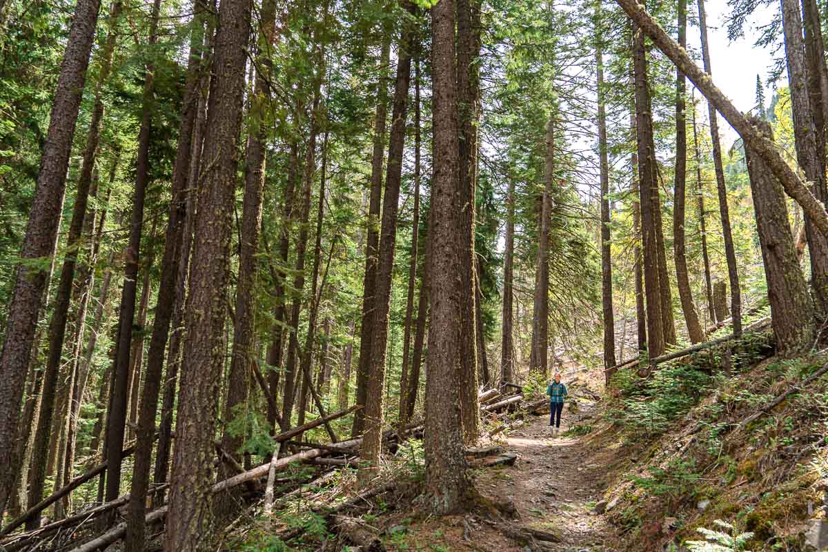
Wallowa Mountains
Located in the remote north eastern corner of the state, the Wallowa Mountains are one of Oregon’s most “overlooked” wonders. People know they’re gorgeous, they’re just hard to get to!
Referred to as “Little Switzerland,” the Wallowas offer some of the most spectacular alpine landscapes in the state and offer a range of outdoor activities from hiking and backpacking, boating, and mountain biking.
Recommended Time: 2 Days
There’s a lot to do in the Wallowas and since it takes such a long time to get out there, we recommend you spend at least two days. If you’re interested in checking out the many multi-day backpacking trips, you might want to stay longer.
Know Before You Go:
- If you’re planning on doing some backcountry hiking, be sure to check the snowpack ahead of time.
- Many amenities operate on a seasonal basis, with Memorial Day and Labor Day serving as the rough start and end of the season.
- Prepare for a range of weather conditions, especially if you’re planning on hiking or taking the tram up to higher elevations.
What to do in the Wallowas
Day Hikes
Iwetemlaykin State Heritage Site (1.8 miles): Pronounced ee-weh-TEMM-lye-kinn, this state heritage site is part of the ancestral homeland of the Nez Perce Tribe located near the town of Joseph.
Chief Joseph Summit Trail (7.3 miles): This out-and-back trail leaves directly from the Wallowa Lake State Park campground and offers stunning views of the lake and surrounding mountains.
Backpacking
Mirror Trail To Eagle Cap (19.6 miles): This lightly trafficked, out-and-back trail has 4,248 ft of elevation gain and leads to the spectacular Mirror Lake.
Hurricane Creek Trail (19.1 miles): A moderately trafficked out-and-back trail with 2,860 ft of elevation gain, Hurricane Creek Trail closely follows Hurricane Creek up a long valley.
Ice Lake (16 miles): Ice Lake Trail is a moderately trafficked out-and-back trail with 3,530 ft of elevation gain. It leads to the scenic Ice Lake, which is a good base camp for a summit attempt of the Matterhorn and Sacajawea Peak.
Tours and rentals around Wallowa Lake
Wallowa Lake is a 3.5 mile long ribbon lake that was formed thousands of years ago by glaciers. Surrounded by mountains on three sides, it offers spectacular views of the surrounding landscape.
Wallowa Lake Marina / Jo Paddle: If you’re visiting the area and want to spend some time out on the water, then we recommend heading over to Wallowa Lake Marina. They offer paddleboard, kayak & canoe, and even motorboat rentals.
White Water Rafting: For a more spirited adventure out on the water, consider booking a trip with Winding Water River Expeditions. We’ve been on multiple white water rafting trips before and have never regretted it.
Wallowa Lake Tramway: Ascending 37,000 vertical feet from the valley floor to the top of Mt. Howard, the Wallowa Lake Tramway offers an incredible gondola experience. The schedule is highly seasonal, so check ahead to see when the tram is running.
Hells Canyon Side Trip: A quick pop over the state line to Idaho will allow you to explore Hells Canyon scenic byway. Hells Canyon is the deepest canyon in the country (yes, deeper than the Grand Canyon).
Where to Eat
Terminal Gravity Brewing (Enterprise): Small town brewery with a large presence in the state of Oregon, Terminal Gravity has a great brewpub location.
Old Town Cafe (Joseph): Small cafe in downtown Joseph, serving up classic Americana fare.
M. Crow & Company General Store: This general store has been in operation since 1907, but it has certainly kept up with the times. Offering a wide variety of food stuffs, clothing, ceramics, and beverages with a modern sensibility.
Where To Stay
Camping
Wallowa Lake State Park Campground: Located at the southern tip of Lake Wallowa, this is a full-service campground complete with showers, flush toilets, and electric hookups. It is located close to shops, restaurants, mini-golf, go-karts, and the tramway as well as many of the most popular trailheads.
Hurricane Creek Camping: This is a small first-come, first serve campground located in the foothills west of Joseph. It’s much more rustic than the state park campground and can be a bit of a trek to get up to, but can serves as a nice basecamp for many nearby hikes.
Additional Resources
Getting from the Wallowas To Mt. Hood
Route: Retrace Route 82 back to La Grande, where you will connect with the I-84 westbound. Once you arrive in Hood River, take Route 35 soundbond to Government Camp.
This is a big driving day, so be sure to leave yourself plenty of time. It will also offer a preview of the upper Columbia River Gorge.
- Travel the Upper Columbia River Gorge: While the Upper Columbia River Gorge lacks some of the impressive features of the lower section, as you travel you will see the steady progression from flat rolling hills to sharp jagged cliff edges.
- Rowena Crest Overlook: Before arriving in Hood River, consider turning off at Rowena to travel historic Route 30. It parallels the I-84, but it is vastly more enjoyable to drive and offers some stunning vistas from the overlook at the top. Be sure to stop at the Rowena Crest Overlook.

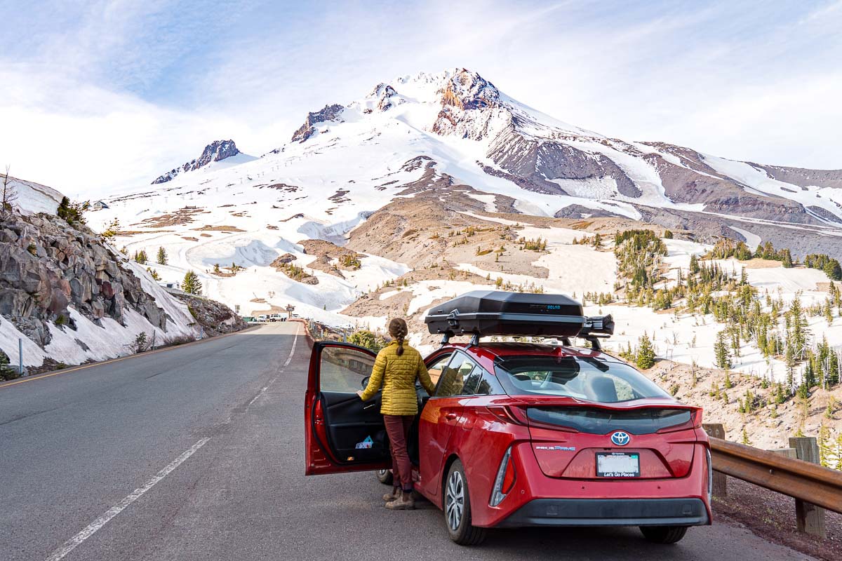
Mount Hood
As the tallest mountain in the state (11,249 feet) and one of the most prominent peaks in the country (7,706 ft), Mount Hood is by far the most iconic mountain in Oregon.
It features 12 named glaciers, world class skiing, and boasts the only year-round ski lift in North America. Located just 50 miles outside of Portland, the Mount Hood area is a very popular destination for outdoor enthusiasts looking to escape the city.
Recommended Time: 1-2 Days
Mount Hood is big! Just driving around the mountain to the different attractions takes a lot of time, so we would definitely recommend spending at least 1 to 2 days here. There is plenty to do as well, especially if you include side trips to the Fruit Loop and/or Hood River.
Know Before You Go:
- Check snowpack conditions before planning any hiking trips. Many of the campgrounds and trailheads can be closed late into the summer.
- The mountain can make its own weather, so be sure to check local weather forecasts. We also recommend checking the various webcams around Mount Hood to verify what is actually happening on the mountain right now.
- Mount Hood’s proximity to Portland means many of the more popular attractions and trails will be busy during the summer and on weekends.
What To Do
Spend the afternoon at Trillium Lake
In addition to having one of the best campgrounds in the entire state, Trillium Lake has an incredible day-use area as well. Hike around the lake, swim, paddleboard, and fish. You can easily spend a wonderful afternoon hanging out at the lake.
Poke around Government Camp
This small ski town features a quaint main street with a pedestrian friendly Bavarian vibe. Shops, restaurants, cafes, and breweries.
Hiking
Ramona Falls Trail (7.1 miles): This is a popular loop trail on the west side of Mount Hood. The road that leads to the trail is often affected by seasonal closures.
Timberline Lodge to ZigZag Canyon (4.7 miles): This is a heavily trafficked trail on the south side of Mt. Hood, leaving from the historic Timberline Lodge.
Cooper’s Spur via Eliot Glacier (10 miles): This is a challenging hike on the east side of Mt. Hood that takes you above the treeline and towards Eliot Glacier.
Visit the historic Timberline Lodge
Constructed during the Great Depression, Timberline Lodge stands on the south slope of Mount Hood at an elevation of 6,000 feet. Featuring a hotel and restaurant, this historic landmark is open to the public and absolutely worth a visit!
Where to Eat
Mt. Hood Brewery (Government Camp): Great local beers and classic brewpub fare located on the far west side of Government Camp.
Solera Brewery (Parkdale): Located in the quaint town of Parkdale, Solera Brewery has outdoor space with absolutely stunning views of Mount Hood.
Moby Coffee Roasters (Parkdale): Moby Coffee roasters is a cozy little spot to grab a coffee either at the start or end of the Fruit Loop.
Mt. Hood Roasters Coffee Company (Rhododendron): A delightful coffee roaster along Route 26. Laid back, PNW vibes.

Where To Stay
Camping
Trillium Lake Campground: This is one of our favorite campgrounds in the entire state. We love spending a relaxing afternoon at the lake, gazing up at Mount Hood. During the summer, there are paddleboard and canoe rentals right at the edge of the campground and the lake. There is also a boardwalk trail that leads around the lake.
Tollgate / Camp Creek: Both of these campgrounds are located to the west of Government Camp and typically clear of snow earlier in the season than Trillium Lake.
Toll Bridge Park: Located north of Mount Hood, near Parkdale, this first-come, first-served campground is at a lower elevation. While this campground doesn’t have the alpine setting of the campgrounds closer to the mountain, it typically has warmer and more mild weather. This is a great place to set up and explore the Fruit Loop.
Additional Resources
Getting from Mt. Hood to the Columbia Gorge
Route: Take Route 35 north to Hood River. Take the 84 west towards Portland.
Getting back to the Columbia River Gorge requires a little backtracking, but you can do a slight detour through Parkdale to check out the Fruit Loop (see below) or spend a little more time exploring Hood River. Both are worth it!
- The Fruit Loop: Bucolic orchards and U-Pick berry fields. Traveling along Route 281 from Parkdale to Hood River, you will pass through some of Oregon’s most prolific orchards and berry fields. Known as The Fruit Loop, visitors can stop off at one of the many U-Pick locations, tour the farms, and experience how good fresh produce can be!
- Hood River: Hood River is one of our favorite towns in Oregon and you can easily spend a day or two there: going to restaurants, brewery hopping, checking out the shops. The waterfront area has recently been revitalized and is a great place to watch the many kite and windsurfers cruising the river. Here are a few places to check out:
- Stoked Roasters: If you’re looking for a quick cup of coffee stop and a place to stretch your legs, head over to Stoked Roasters. They’re down by the waterfront, with a great park across the street, offering great views of the river.
- Bette’s Place: Known as the “Friendliest Restaurant in Town” Bette’s Place is a local treasure. Serving up classic Americana fare, this down-to-earth diner is an absolute delight.
- Lake Taco: Central Oregon features a lot of “Americana” cuisine, but at last, there’s a taco shop to write home about. Stop by Lake Taco and you won’t be disappointed!
- Broder Øst: Coffee and Scandinavian breakfast staples with a minimalist vibe.
- Kickstand Coffee: Craft coffee, beer & wine, global fare, great outdoor seating. This place is a mashup of everything we love about Oregon.

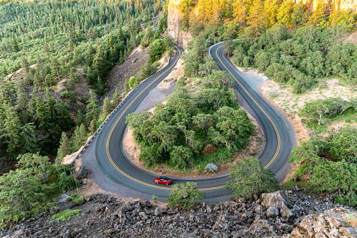
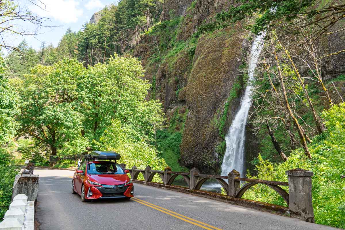
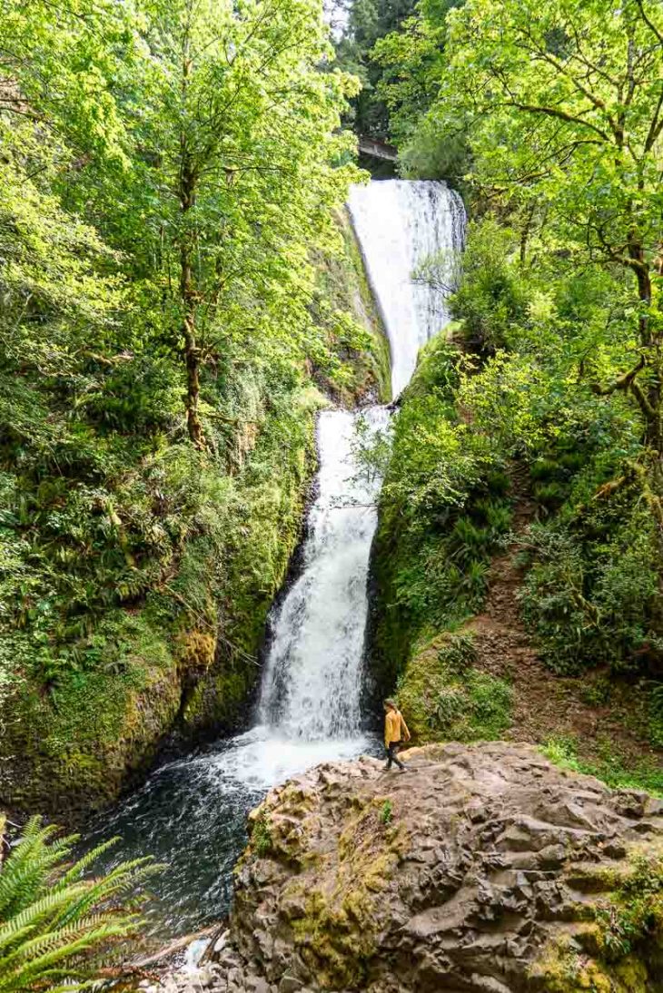
Columbia River Gorge
The Columbia River Gorge is the largest National Designated Scenic Area in the country and for good reason. From Hood River to Portland, you’ll experience a non-stop barrage of breath-taking views.
This massive canyon is formed as the Columbia River cuts its way across the Cascade Mountains en route to the Pacific Ocean. With hundreds of waterfalls, spectacular trails, and world-class wind and kite surfing, the Gorge has become an internationally known destination for adventure seekers.
Recommended Time: 1-2 Days
It’s only 65 miles from Hood River to Portland on the I-84 freeway, but all the “good stuff” is off the main road. Stunning hikes, quaint towns, and incredible vistas are tucked away along the winding canyon. There is also the entire Washington State side of the gorge to explore too!
Know Before You Go:
- Plan ahead, don’t navigate on the fly! If you are not intentional, there is a real risk of getting swept away by the flow of traffic. The I-84 is a fast moving freeway, with limited exits that make doubling back difficult.
- The Columbia River Gorge is notoriously windy. Like “Windsurfing Capital of World” windy. So make sure you have warm layers and a windbreaker.
- Given its proximity to Portland, it is most crowded with tourists on the weekends and commuters during rush hours during the week.

What To Do
Take in the views at the Rowena Crest Viewpoint
If you didn’t hit the Rowena Crest Viewpoint on the way in from the Wallowas, we would definitely recommend backtracking a little to go check it out. It’s an incredible vista point and a very pleasant drive.
Bridge Of The Gods
The Bridge of the Gods was iconically featured in the film (and book) “Wild”. It’s where the Pacific Crest Trail crosses the Columbia River on its way up to Canada. It’s also how you would get over to the town of Stevenson, WA, which is worth checking out. The bridge has a $2 toll for automobiles.
Hikes
There are dozens of great hiking trails along the Oregon side of the Columbia River Gorge. Many of them are short out-and-back to various waterfalls, but you can also connect a few of them together to form longer loops.
Multnomah Falls Trail (2.4 miles): This heavily trafficked trail leads to Oregon’s most well-known waterfall: Multnomah Falls. There is a large parking lot, restrooms, and a concession stand. Because of the ample parking, this is a good place to set up and connect the trail to some of the other falls in the area. This is a great map if you want to extend the hike (and get away from the crowds)
Wahkeena Falls Loop Trail (5.1 miles): This heavily trafficked loop trail picks up 1,656 feet of elevation and brings hikers to one of the best waterfalls on the Oregon side: Wahkeena Falls!
There are just so many hikes to choose from, we recommend spending some time checking out the many available options on All Trails.
Chasing Waterfalls
You don’t have to see them all, but these are some of the best waterfalls in the area.
Check out this guide to the 15 must-see Columbia River Gorge waterfalls on Territory Supply.
Kiteboard or WindSurf
If you’re interested in learning how to Wind or Kite Surf, there is no better place than in Hood River. Pop over to Cascade Kiteboarding and reserve an instructional lesson.
Vistas from Vista House
Built in 1917 on one of the most scenic points in the Gorge, the Vista House sells regional artwork, local gift items, and espresso. It’s a great place to get out of the car and take in the views.
Looking to photograph the Vista House? The best location is from Portland Women’s Forum State Scenic Viewpoint with a telephoto lens!
Where to Eat
Eastwind Drive-In (Cascade Locks): This burger & ice cream shack is a local favorite. For many, it’s a requisite stop for any trip into the gorge.
Thunder Island Brewing (Cascade Locks): Grab a beer and enjoy the scenery at Thunder Island Brewing. They have a fantastic deck that offers spectacular views of the river.
BigFoot Coffee Roaster (Stevenson, WA): The best gas station coffee you’ll ever have! This quaint coffee roaster is full of charm and character, but just so happens to be located in the same building as a Chevron.

Where to Stay
Memaloose State Park Campground: State Park campground overlooking the Columbia River Gorge. There is a very active train line nearby and very bold ground squirrels, but otherwise a scenic location.
Wyeth Campground: Campground located on the inside of the I-84 corridor, but with many nearby hiking trails.
Additional Resources:
- The Gorge Guide by The Gorge Guide
Getting from to Columbia Gorge to Portland
Route: Just as the mighty Columbia River pours downstream towards Portland, so does the I-84 westbound. Just follow the highway and you’ll be in Portland in no time.

Portland
*Not one of the seven wonders of Oregon*
While it’s not one of the official 7 Wonders, an Oregon road trip would not be complete without visiting Portland, at least for a day or two.
If you are traveling from out of state, you might end up starting and your trip in Portland (by flying into PDX) but if you are coming from Bend, you’ll want to spend a little time in Portland before heading out to the coast.
We couldn’t even begin to cover all the attractions in Portland, so we’ll provide some links below to other bloggers who have compiled much more comprehensive guides.
- Travel Portland
- 33 Weirdly Awesome Things to Do in Portland by Two Wandering Soles
- 14 Things to See and Do in Portland by Nomadic Matt
- Portland Bicycle Tours
- Things to Do in Portland by Embrace Someplace
Getting from Portland to the Coast
Depending on where you want to start your adventures on the coast, you have a couple of options:
To Astoria: If you are intent on doing the entire coast, then you’ve got to start at the top in Astoria. Then US Route 30 westbound is your ticket.
To Cannon Beach: If you’re like many Portlanders and want to beat a straight(ish) line to the coast, then take US Route 26 to Cannon Beach.
To Lincoln City: If you need to save time and are okay shaving about a ⅓ of the coast off, then you can drop down to Lincoln City via US Route 18.

The Oregon Coast
Spanning 363 miles, Oregon’s Coast—in our opinion—is the most impressive coastline in the entire country (yes, we’ve been to Big Sur). Towering pine forests, massive rivers, rugged rock outcroppings, and spectacular coastal dunes: the Oregon Coast has a raw, prehistoric beauty we haven’t seen anywhere else.
Travel US 101 as it passes through quaint fishing towns, bucolic farmlands, picturesque lighthouses, and historic bridges. The Oregon Coast has so many different attractions, your biggest challenge will be prioritizing what to do!
Recommend Time: 3-7 days
It’s hard to give a recommended time frame for this section, not only because it’s so large (5,200 square miles large), but because there are so many genuinely interesting things to check out.
Three days would be the bare minimum to get a rough “impression” of the coast, but something more like 5-7 days would give you an actual experience.
Know Before You Go:
- Traveling north to south along the coast is ideal because most of the scenic overlooks will be on the right, making pulling off and getting back on the road much easier.
- Much like the Columbia River Gorge, the road is so scenic you can easily get carried away and just keep driving. Be intentional, you will need to seek out many of the “hidden” gems.
- Learn about the risks of sneaker waves (extremely powerful waves that offer no advanced warning). Never turn your back on the ocean.
- Beware of slippery rocks, muddy trails, and exposed roots. The rugged coastline is beautiful, but can also be quite hazardous.
- Locals call it “the coast” not “the beach” for a reason! The air can be windy and cool—even in the middle of summer—and the water of the Pacific Ocean is always cold. Bring layers!
Best Oregon Coast towns to visit
Unlike the other 7 Wonders of Oregon, which are relatively compact in size, the coast is so large that it’s hard to reduce everything down to a simple list.
So instead, we’ve grouped attractions together by their proximity to the most noteworthy towns. All of these towns are worth stopping in (even if just briefly), and they make for good basecamps to load up on supplies, grab a bite to eat, and refuel with gas and/or coffee.

Astoria
Situated on the Columbia River right before it empties into the Pacific Ocean, Astoria is the most northerly town on the Oregon coast. While the hilltop neighborhoods are quite lovely and pockets of Victorian architecture are reminiscent of San Francisco, the downtown and waterfront area definitely has a gritty, working class vibe.
Visit: Columbia River Maritime Museum, Astoria Column ($5 entry fee), Flavel House Museum, Fort Stevens State Park
Eat: Astoria Coffee House & Bistro, Bowpicker Fish & Chips, Surf 2 Soul (food truck), Busu (Japanese food stand), Fort George Brewing (Brew Pub), Buoy Brewing (Brew Pub)
Coffee: Coffee Girl
Camp: Fort Stevens State Park
Additional Resources: 25 Things to Do In Astoria by Travel Astoria
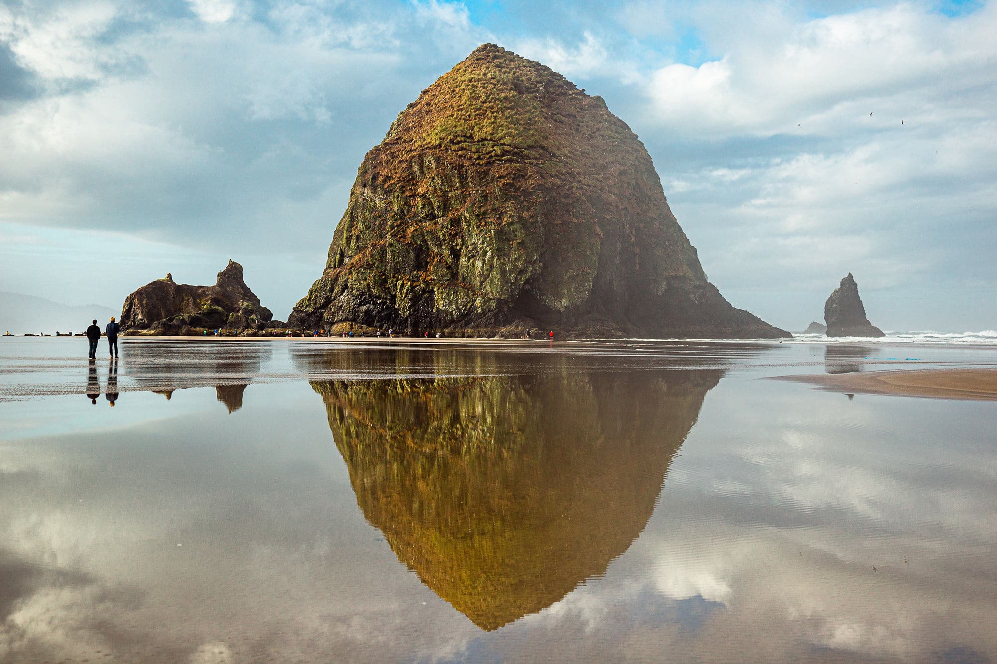
Cannon Beach
In our opinion, Cannon Beach is one of the quaintest towns on the Oregon coast. With a charming downtown and plenty of outdoor recreation in the area, this is a great place to spend a bit of time. On a sunny weekend in summer, Cannon Beach is where Portlander’s go “coasting”.
Visit: Haystack Rock, Ecola State Park, Hug Point, Indian Beach
Hike: Crescent Beach Trail (2 miles), Clatsop Loop Trail (2.8 miles), Neahkahnie Mountain via South Trailhead (2.7 miles)
Eat: Ecola Seafood Restaurant, Lazy Susan Cafe, Sea Level Bakery + Coffee
Coffee: Insomnia Coffee Company, Sleepy Monk Coffee Roasters, Bald Eagle Coffee House
Camp: Wright’s For Camping
Additional Resource: 14 Adventurous Things to Do in Cannon Beach by Oregon is for Adventure

Manzanita
Located just south of Cannon Beach, the town of Manzanita is just as quaint but more relaxed and less crowded. Nearby camping at Nehalem State Park actually makes this a better place to set up a basecamp than Cannon Beach. Definitely worth a stop.
Visit: Oswald West State Park, Nehalem State Park, Neahkahnie Viewpoint
Hike: Cape Falcon Trail (4.6 miles), Neahkahnie Mountain via South Trailhead (2.7 miles), Short Sands Beach Trail (1.2 miles)
Eat: Offshore Grill & Coffeehouse, Wanda’s Cafe + Bakery, Yolk, Left Coast Siesta
Coffee: Manzanita Coffee Co, Manzanita News & Espresso,
Camping: Nehalem State Park
Additional Resources: Guide to Nehalem State Park by Oregon is for Adventure

Tillamook
Known throughout the state as the home of the Tillamook Creamery, the town of Tillamook has a lot more than just dairy products (although it does have a lot of great dairy products).
Visit: Cape Meares State Park, Cape Lookout State Park, Tillamook Creamery, Three Capes Scenic Drive (40.9 miles)
Drive: Take Scenic Route to Pacific City via Cape Lookout Rd and Sandlake Rd
Hike: Bayocean Peninsula (7.5 miles) Cape Meares Lighthouse Loop (½ mile)
Eat: Tillamook Creamery, Recess, JAndy Oyster Co., Werner Beef & Brew
Coffee: Five Rivers Coffee Roaster
Camping: Cape Lookout State Park Campground
Additional Resources: Tillamook Coast Things to Do

Pacific City & Neskowin
Massive sand dunes, beaches you can drive on, and spectacular vistas, Pacific City is definitely worth a stop during your trip on the coast. Slightly further south, the small town of Neskowin is often overlooked by tourists and offers a nice break from the crowds.
Visit: Cape Kiwanda State Natural Area, Bob Straub State Park, Sand Lake Recreation Area, Proposal Rock
Hike: Sitka Sedge State Natural Area Loop (3.5 miles), Marsh, Bay, and River Trails Loop (4.9 miles) Hart’s Cove Trail, (5.6 miles)
Eat: Beach Wok (Asian fusion), Los Caporales (Mexican), The Riverhouse Nestucca (American bistro)
Coffee: Stimulus Coffee + Bakery, Grateful Bread Bakery
Camping: Sandbeach Campground, Neskowin Creek RV Resort
Additional Resources: 11 Adventurous Things to Do in Pacific City by Oregon is for Adventure
Lincoln City
Stretched along the main business corridor on US-101, Lincoln City doesn’t have a centralized downtown. With the Pacific Ocean to the west and Devil’s Lake to the east, it does offer a nice mix of saltwater and freshwater activities.
Visit: Roads End State Recreation Area, Siletz Bay Park, Boiler Bay State Scenic
Hike: God’s Thumb – The Knoll Loop (4.7 miles)
Eat: Autobahn 101 (German), Best Thai (Thai), Nelscott Breakfast House (American diner)
Coffee: Nyla’s Cup of Jo
Camping: Devil’s Lake State Recreation Area
Additional Resources: 15 Adventurous Things to Do in Lincoln City by Oregon Is For Adventure

Newport
Featuring a historic bayfront, iconic lighthouse, and Oregon’s largest aquarium, Newport is definitely worth a visit. The historic bayfront serves double duty both as a tourist destination and an actual working port, so it can get a little crowded.
Visit: Devil’s Punch Bowl, Yaquina Head LightHouse, Newport Aquarium, Historic Newport Bayfront,
Hike: Yaquina Head Lighthouse and Cobble Beach Loop Trail (0.4)
Eat: South Beach Fish Market (seafood), Newport Brewing Company (brew pub) La Maison (french bakery)
Coffee: Coastie Roastie, The Coffee House
Camping: Beverly Beach State Park, South Beach State Park
Additional Resources: Discover Newport

Yachats
The small town of Yachats (pronounced “YAH-hots”) has a super cute downtown and is close to a lot of great coastal features, including Thor’s Well.
Visit: Cape Perpetua Scenic Area, Devil’s Churn Scenic Overlook, Thor’s Well, Yachats State Recreation Area.
Hike: Captain Cook Trail and Thor’s Well (0.6 miles), Saint Perpetua Trail (2.7 miles), Cook’s Ridge and Gwynn Creek Loop Trail (6.4 miles) Cumming Creek Trail (5.8 miles)
Eat: Yachats Brewing & Farmstore (farm style brewery)
Coffee: Green Salmon, The Village Bean, Bread & Rose Bakery
Camp: Cape Perpetua Campground, Tillicum Beach Campground
Additional Resources: 10 Epic Things to Do in Cape Perpetua by The Mandagies

Florence
Roughly the half-way mark down the coast, Florence is known for its massive coastal sand dunes, picturesque Heceta Head Lighthouse, and an abundance of freshwater lakes. It also features our favorite bridge along the coast, the 1938 art deco styled Siuslaw River Bridge.
Drive: Rent a dune buggy or take a guided tour of the dunes
Visit: Jessie M. Honeyman Memorial State Park, Heceta Head Lighthouse, Darlingtonia State Natural Site,
Hike: Hobbit Trail to China Creek (4 miles), Heceta Head Lighthouse Trail (0.9 miles), Sutton Creek Dunes (4.1 miles)
Eat: Bridgewater Fishhouse (seafood), Chens Family Dish (American Chinese), Big Dog Donut (donuts)
Coffee: River Roasters
Camp: Jessie M. Honeyman Memorial State Park Campground

Coos Bay-North Bend
The adjacent communities of Coos Bay and North Bend make up the largest town on the Oregon coast. So if you’re feeling burnt out on stunning vistas and epic coastlines, then consider resetting by stepping into one of the many museums and gardens in the area.
Visit: Cape Arago State Park, Coos Bay History & Maritime Museum, Shore Acres State Park, Mingus Park (Japanese Gardens), Coos Bay Art Museum
Hike: Cape Arago Loop (1.2 miles), Sunset Bay to Cape Argo (8.5 miles)
Eat: Vinny ‘s Smokin’ Good Burgers & Sandwiches (sandwiches), Noster Kitchen (smoothies & bowls), The Alder Smokehouse (BBQ) , 7 Devils Brewing (brew pub)
Coffee: Grounds Cafe
Camp: Sunset State Park
Additional Resources: 10 Things to Do Near Coos-Bay by The Mandagies

Bandon
The small, charming town of Bandon is known for its historic lighthouse and impressive sea stacks. It also has a walkable downtown that features a few exceptional dining options that make it worth a stop.
Visit: Face Rock Viewpoint, Bandon State Natural Area, Coquille River Lighthouse, Bullards Beach,
Check out: Bandon Circles in the Sand
Hike: Face Rock Viewpoint Trail (0.3 miles), Bandon Oregon Coast Walk (4.5 miles) New River Area Trails (2.4 miles)
Eat: Wilson’s Market (grocery store + sandwich shop), Tony’s Crab Shack (seafood), Pablo’s Corner (Argentine) Shoestring Cafe (Americana)
Coffee: Bandon Coffee Cafe
Camp: Bullard Beach State Park Campground

Port Orford
The sleepy little town of Port Orford marks the start of the most impressive section of the Oregon Coast. If you are traveling the coast North to South, you’ve saved the best for last!
Hike: Port Orford Headlands Trail (1.2 miles) Humbug Mountain Trail (5.1 miles) Sisters Rock (0.9 miles)
Eat: Crazy Norwegian Fish & Chips (seafood) Golden Harvest (farmhouse) The Nest Cafe (Americana)
Coffee: Tasty Kate’s
Camp: Humbug Mountain State Park
Additional Resources: Port Orford by Travel Oregon

Brookings
The last Oregon town before dropping into California, Brookings is the most remote town on the coast. It is also one of the most spectacular. The road down through Samuel Boardman Scenic Corridor – in our opinion – is the most stunning section of the entire US Pacific coastline.
Visit: Cape Sebastian Scenic Corridor, Samuel Boardman Scenic Corridor, Chetco Point Park, Harris Beach State Park, Azalea Park
Hike: Natural Bridge View Point Trail (0.7 miles), Redwood Nature Trail (1.1 miles), Indian Sands Trail (1.1 miles), Secret Beach Trail (1.6 mile), Thomas Creek Whaleshead Beach Trail (2.9 miles)
Eat: Hungry Clam (seafood), Khun Thai (Thai)
Coffee: Bell & Whistle Coffee House, Compass Rose Coffee
Camping: Harris Beach State Park
Additional Resources: 12 Things To Do In Brookings by Tourist Secrets
Additional Oregon Coast Resources
- 11 Most Scenic Oregon Coast Towns by Oregon is for Adventure
- Oregon Coast Road Trip by Two Wandering Soles
- Oregon Coast Road Trip Itinerary by The Mandagies
- 10 Best Oregon Beach Towns by Oregon Live

Getting from the Coast to Crater Lake
Route: If you made it all the way down to Brookings, you’ll probably need to hook down into California in order to head back up to Crater Lake. Follow US-101 south before hooking up to the US-197 and then continuing northwards on US-199.
- Jedediah Smith Redwoods State Park (CA): You’ll be passing right by one of the most impressive collections of California redwoods, so consider a quick stop here.
- Painted Cave Bakery (Kerby): A funky farmhouse/road stand bakery and coffee shop.
- 808 Ohana Grindz (Grant Pass): This is a very casual lunch and dinner spot that offers authentic Hawaiian fare.
- Rogue Roaster (Grant Pass): Great local coffee shop with an industrial roaster vibe.
From Grants Pass, it’s just a short ride on I-5 South until you reach US Route 234, which you’ll take to connect Route 64.

Crater Lake National Park
Famous for its deep blue color and water clarity, Crater Lake is situated deep inside the collapsed volcanic caldera of Mt. Mazama. With a maximum depth of nearly 2,000 feet, Crater Lake is the deepest lake in the United States and ninth deepest in the world. It is also – quite surprisingly – the only National Park located in the state of Oregon.
Recommended Time: 1-2 Days
The main attraction of visiting Crater Lake is to see the lake. However, the weather doesn’t always cooperate. Clouds have a tendency to settle inside the caldera, obscuring the lake entirely. So give yourself a little extra time in case you need the weather to shift.
Know Before You Go
- Crater gets a lot of snow over the winter; snow-related road closures can be in effect deep into the summer months. So be sure to check before you go.
- Campgrounds around Crater Lake often don’t open until July due to snowpack, so you may need to set up camp at lower elevation outside the park.


What To Do
Drive, Bike, or Take a Trolley Ride on the Rim Road
There is a 32.9 mile scenic road that loops around the rim of the Crater Lake caldera offering stunning 360 degree views. Dotted with scenic overlooks and vista points, this road can be driven or biked. During the summer months, the park also operates a trolley tour allowing you to take in the views.
Hikes
Discovery Point Trail (4 miles) – Departing from Rim Village and heading west, this heavily trafficked out-and-back trail will take you nearly all the way to Wizard Island.
Mount Scott Trail (4.2 miles) – Located on the eastern side of the caldera, the Mount Scott Trail will take you up to the highest point in the Crater Lake caldera. Here you will be rewarded with spectacular panoramas of the surrounding area.
The Watchman Peak Trail (1.7 miles) – Located on the western side of the caldera, the Watchman Peak trail will lead you to the high point directly behind Wizard Island.
Garfield Peak Trail (3.4 miles) – Departing from Rim Village heading east, this out-and-back trail skirts along the caldera’s edge as it ascends to a high vista point near Eagle Crags.
Swim in Crater Lake
Yes, you can swim in Crater Lake! However, there is only one trail that descends down to the lake’s edge. Cleetwood Cove Trail is a 2.1 mile out-and-back trail that drops 600 feet to Cleetwood Cove.
But be prepared for a chill! Even after a long hot summer, the surface water at Crater Lake is usually only around 55-60 F. But the steep climb back up the rim should warm you up!
Explore Wizard Island
There is only one way to get out to Wizard Island and that is via a Crater Lake Boat Tour. They offer a three-hour, half-day drop-off or a full-day, six-hour stay. Once on the island, there is a summit trail that will lead you to the top of the cinder cone. There is no overnight camping allowed on Wizard Island, but there are restrooms.
Where to Eat
Beckie’s Cafe: Rustic mainstay since 1926 offering homestyle American staples, homemade pies & regional microbrews.
Rim Village Cafe: Location, location, location! As the only restaurant/food option located on the rim, Rim Village Cafe has a lock on the food scene within the park. It’s expectedly overpriced but in no way egregious.
Where to Stay
Towards the end of a camping-heavy trip, we feel it’s nice to book a stay at an established lodge or cabin. Crater Lake is a great place to consider this as well since many of the campgrounds don’t open up until deep into summer.
Hotels
Crater Lake Lodge: The closest you can stay to the lake, the Crater Lake Lodge (71 rooms) is perched on the edge of the caldera and overlooks the lake at Rim Village.
Mazama Cabins: The Cabins at Mazama Village are nestled high in the Ponderosa pines, seven miles south of Rim Village.
Camping
Mazama Campground: Open only in the summer, Mazama Campground is a first-come, first-serve campground with 214 sites in an old-growth forest
Lost Creek Campground: Managed by the National Park Service, Lost Creek Campground is a first-come, first-serve campground for tent campers only. No RVs, buses, vans, or truck campers are allowed.
Joseph H Steward Campground: Located about an hour from Rim Village, this campground is at a much lower elevation. If the campgrounds in the park are closed due to snow, this is a good alternative.
Additional Resources
- Ultimate Guide to Crater Lake by Local Adventurer
- Ultimate Guide to Crater Lake National Park by Road Trippers

Getting from Crater Lake to Bend
This was the end of our 7 Wonders of Oregon road trip, but for many people this might be the midway point. If you’re continuing on, we suggest heading to Bend. It’s a great place to visit and a good jumping-off point for Smith Rock and Painted Hills.
Drop down onto the US-97 north and cruise on up.
Newberry National Monument: There are many great hikes and quite a few campgrounds in this area. Paulina Lake is definitely worth checking out.
High Desert Museum: Offering fun and interactive museum experiences, the High Desert Museum will guide you through the geology, plants, and wildlife of the high desert.
Lava River Cave: This is an incredible cave that was formed by a river of lava that once flowed through it. It’s a great place to visit during a hot day as the cave temperatures remain cool and refreshing.
Bend
*Also not one of the 7 Wonders, but a trip to Oregon wouldn’t be complete without a visit!*
As one of the fastest-growing cities in the country, Bend is a dream destination for outdoor enthusiasts. Not only does it have access to skiing, mountain biking, hiking, trail running, and rock climbing, but the city embraces the outdoor vibe with dozens of microbreweries, sprawling city parks, and a walkable/bikeable downtown.
There is no way for us to list all the great things to do in Bend, but here are some of our highlights.
What to Do
Float the Deschutes River
One of the highlights of summer is being able to float the Deschutes River. There are many points throughout town to launch and take out, but the most common start point is at River Bend Park with a take out at the south end of Drakes Park. If you want to rent tubes, paddle boards, kayaks, or canoes, check out Tumalo Creek Kayak & Canoe
Grab a beer
Bend and the surrounding area is home to 22 microbreweries (with a new one opening nearly every year). Many of the breweries are within walking distance of each other.
Stroll through Drake’s Park
Grab a coffee at The Commons or The Looney Bean and take a walk through Dranks Park. Connecting downtown Bend with the Galveston district, Drake’s Park is one of the most charming city parks we’ve ever visited. This pedestrian-friendly space is also where the city hosts live music events and festivals all year round.
Drive the Cascade Scenic Byway
This extraordinary scenic loop takes you deep into the Cascade mountains, offering spectacular views of Mt. Bachelor and the Three Sisters mountains. There are many hiking trails and scenic lakes to check out along the way.
Hikes
There are tons of great hikes in Bend! Here are a handful of our favorite hikes that are right in town:
Tumalo Falls (6.5 miles): Located just outside of town, this heavily trafficked out-and-back trail features the 98 foot tall Tumalo Falls.
Deschutes River Trail (3.1 miles): This is a heavily trafficked loop trail that starts by Farewell Bend Park and follows along the Deschutes River.
Shevlin Park Trail & Tumalo Creek Loop (2.1 miles): Located in the northwest part of town, this trail passes through aspen groves as it follows along the Tumalo Creek.
Pilot Butte (1.8 mile): Located in the middle of town, this heavily trafficked trail spirals up a cinder cone, offering hikers beautiful 360-degree views of the city.
Mountain bike on Phil’s Trail
Phil’s Trail complex is biking distance from downtown and features an absolutely incredible network. If you’re interested in renting a mountain bike while in town, there are dozens of outfitters to choose from.
Where to Eat
Food Truck Pods: Bend has about a half dozen food pods (groups of food trucks) that we feel offer an essential local dining experience. Our favorite food pods are: The Podski, The Lot, On Tap, and Midtown Yacht Club
The Common Cafe: Offering a wide selection of coffee, tea, beers, ciders, and kombucha, the Common Cafe is situated in a historic building at the edge of Drake’s Park. Absolutely perfect location, great back porch, and relaxed vibe.
Sparrow Bakery: With two locations in town, Sparrow Bakery is home of the Ocean Roll – a cardamon-twist on a classic cinnamon roll.
Bonta Gelato: On a hot summer afternoon, nothing hits the spot quite like a cold gelato.
El Sancho Tacos: El Sancho makes some of the best tacos we have ever had (and we used to live in Los Angeles!)
Spork: With an eclectic menu that features classic street foods from around the world, Spork is a much welcomed departure from the omnipresent brewpub fare.
McMenamins Old St. Francis School: An Oregon institution, it’s impossible to fully explain the McMenamins business model. This particular location is located in a converted 1936 Catholic schoolhouse campus and features a quirky hotel, a restaurant, brewery, another restaurant, outdoor bonfire pits, a cigar lounge in an old chapel, a movie theater, and a Russian soaking bath. If any of this intrigues you, just go. It will be well worth the visit.
Where to Stay
Tumalo State Park Campground: With hot showers, a dishwashing station, and access to the Deschutes River, Tumalo State Park Campground is a great full-service campground near town.
LOGE: This outdoors-inspired hotel is situated on the western edge of town along the Cascade Lakes Highway, provides great access to some of the mountain bike trailheads, and is only a five-minute drive or 15-minute bike ride back into town.
Additional Resources
- Visit Bend by Bend Tourism Board
- Ultimate Guide to Bend by Outside Magazine
- 33 Fun Things to Do in Bend by Two Wandering Soles
- Local’s Guide to Bend by Embrace Someplace
Made possible by Toyota
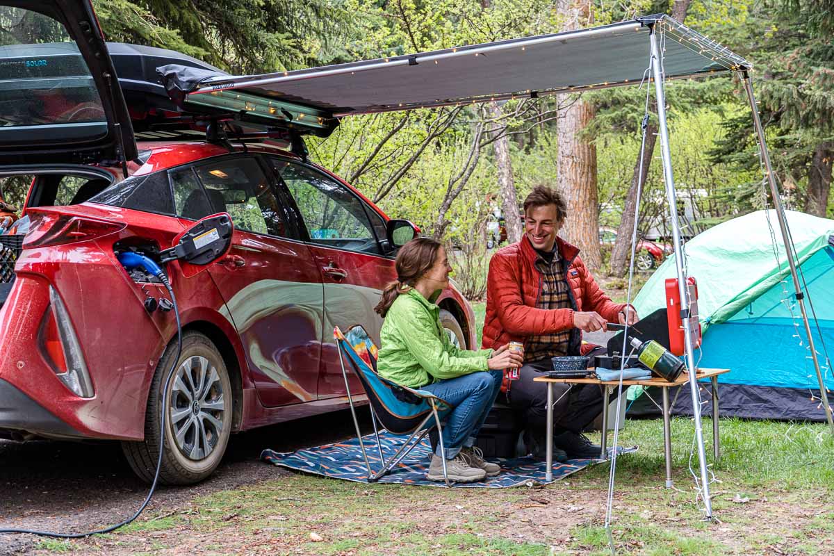
We did this road trip in a Toyota Prius Prime plug-in hybrid, which was lent to us by Toyota. Oregon is a very large state and the 7 Wonders are fairly spread out, so having a comfortable, fuel-efficient vehicle that could carry all our camping gear was absolutely essential.
We think a plug-in hybrid is actually the ideal vehicle for a road trip like this. It allowed us to decrease our fuel consumption by charging at campgrounds, Airbnbs, and rest stops, but the super-efficient gas engine allowed us to spontaneously explore scenic byways without worrying about battery life.
While the vehicle has a ton of interior storage space for all your road trip essentials, it is also really easy to install a roof rack and cargo box. We traveled with a Yakima CBX Solar cargo box. This really expanded our storage capacity while decluttering the inside of the car.
We also had a roof-mounted awning that offered us shade and rain protection. We have always wanted one of these things. Especially out in the high desert of Central Oregon, it’s great to have a way to quickly get out of the sun when camping. It also allowed us to turn nearly any scenic overlook into a quick place to make lunch and soak in the views.
If you are ever in Klamath Falls Oregon, we could fly you over Crater Lake and surrounding areas to get some amazing pictures of the beautiful outdoors!
Wow, that sounds fun!