6 Scenic Drives in Moab that DON’T Require Four Wheel Drive
This post may contain affiliate links.
You don’t need to own a 4×4 jeep or a dune buggy to explore Moab, UT. We’ve compiled a list of rental-car-ready scenic drives that will allow you to experience the breathtaking landscape of Moab, without getting yourselves stuck in the sand!
After exploring St. George and Zion National Park, we packed up the car and drove northeast to the red cliffs of Moab. While we had the luxury of hiking around Zion mostly on foot, we quickly learned that Moab is a driving town. With hundred of miles of double-track trails, this desert town is a mecca for the off-roading community.
Our plucky little Ford Focus has plenty of spunk, but it’s no match for the type of technical off-road terrain found out here. (We could barely manage the dirt road out to our BLM campground.) Thankfully, we did a little research online and uncovered a treasure trove of scenic drives in the area that are readily-accessible for 2-wheel-drive vehicles like ours.
Especially on a hot day, going for a long scenic drive can be a great way to beat the heat. It’s also a great way to get a sense of your surroundings. Crank the A/C, put on some music, and take a spin around Moab.
All of the scenic drives listed below have been tested and approved by our spritely Ford Focus!
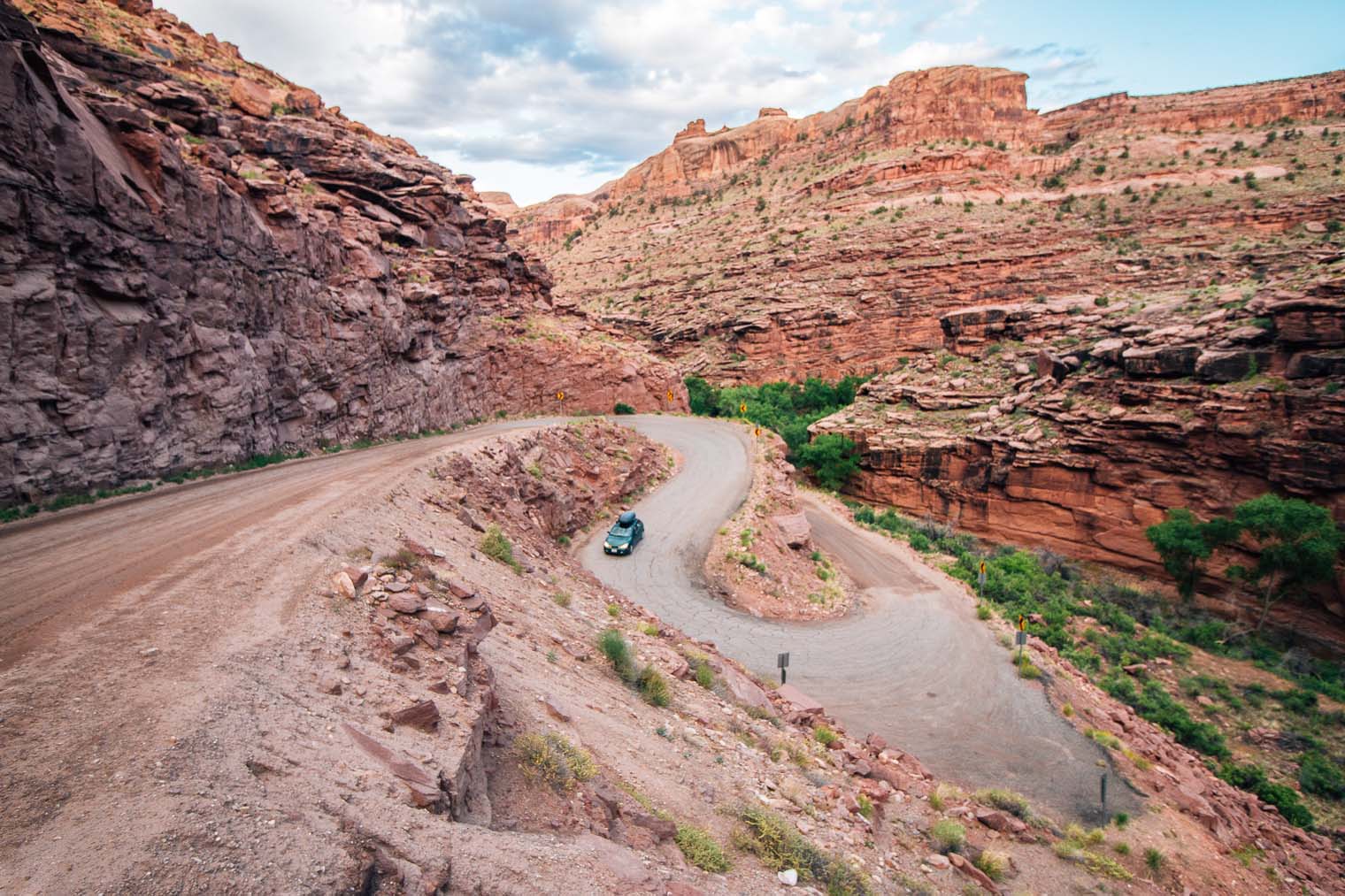
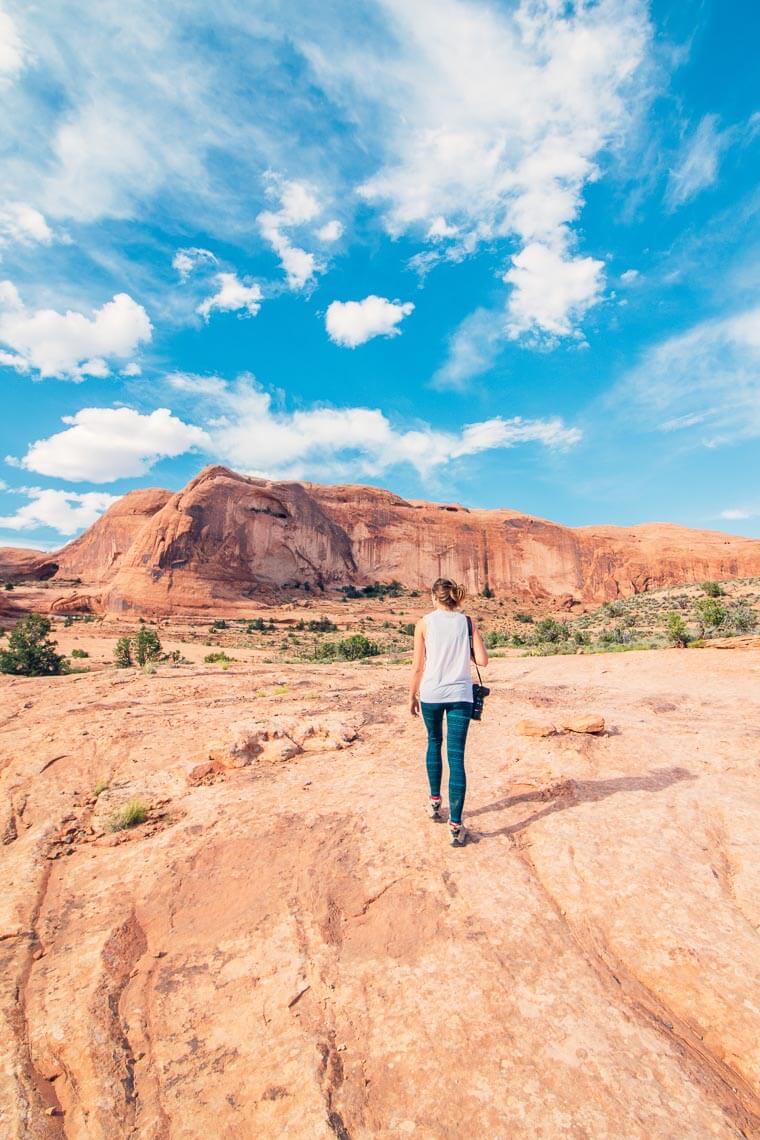
1. Kane Creek (Route 145)
Summary: The road starts from the town of Moab, and follows the eastern side of the Colorado River. The first half is a narrow paved road, while the second half is a well-maintained and incredibly picturesque dirt road. There are lots of great campgrounds along this route, with some of the more spectacular sites being further back in the canyon.
Itinerary
Matheson Wetlands Preserve: As soon as Kane Creek Road connects with the Colorado River, you will arrive at the Matheson Wetlands Preserve. There’s a mile long trail that runs through the preserve, allowing you to catch a glimpse of the over 200 species of birds that live here, as well as other wetland animals, like beavers and river otters.
Moonflower Canyon (2 miles in): A little ways down you’ll see a pull-off on the left side of the road for Moonflower Canyon. There’s a short trail that leads back into the canyon to a reflecting pool. There are 8 primitive walk-in campsites along this trail, so be sure to stay on the path, otherwise you might wander into somebody’s campsite.
Birthing Scene Petroglyph Boulder (6 miles in): After the road turns to dirt, you’ll see a pull off on the left side of the road. Down from the road, you’ll see a larger boulder with petroglyphs on all four sides. Here you will find the famous “Birthing Scene” on the eastern side of the boulder, which faces the road.
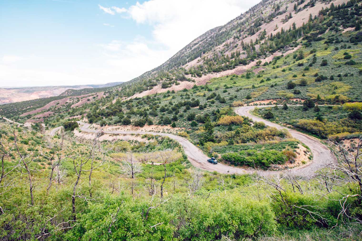
Crazy Switchbacks: So this might be not be for everyone, but a few miles down the canyon after the birthing scene petroglyph, you’ll arrive at some gnarly switchbacks. If you’re timid about driving next to steep ledges then this probably isn’t for you, but if enjoy driving a road that feels like it’s trying to twist and turn from underneath you, then this section can be a lot of fun. There’s also a few more campgrounds down past the switchbacks if you’re looking to camp in the canyon.
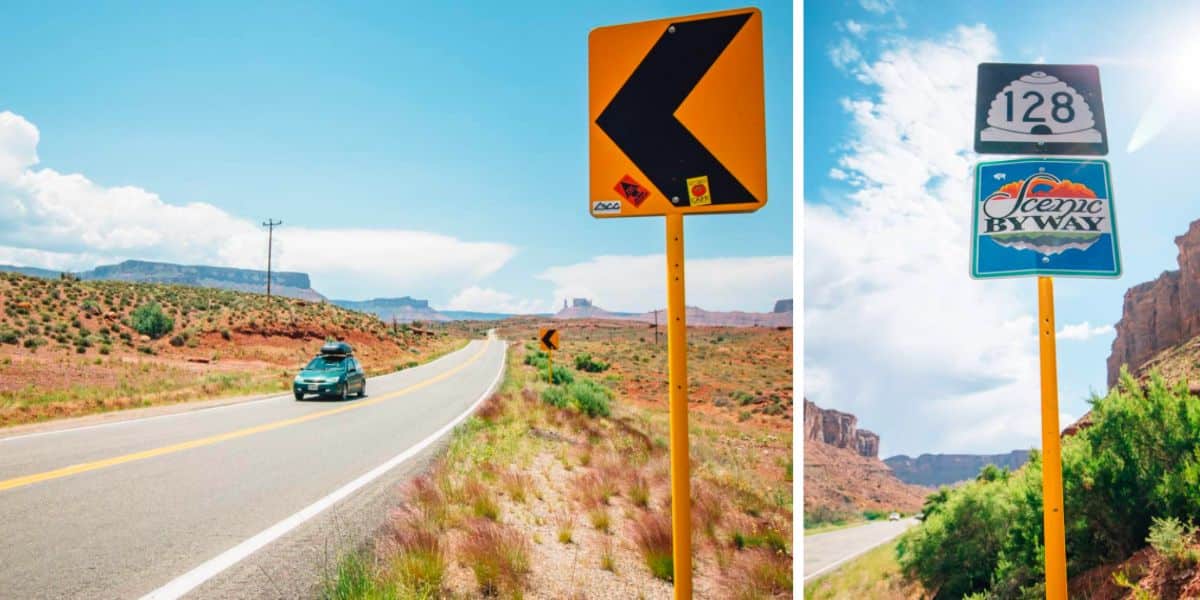
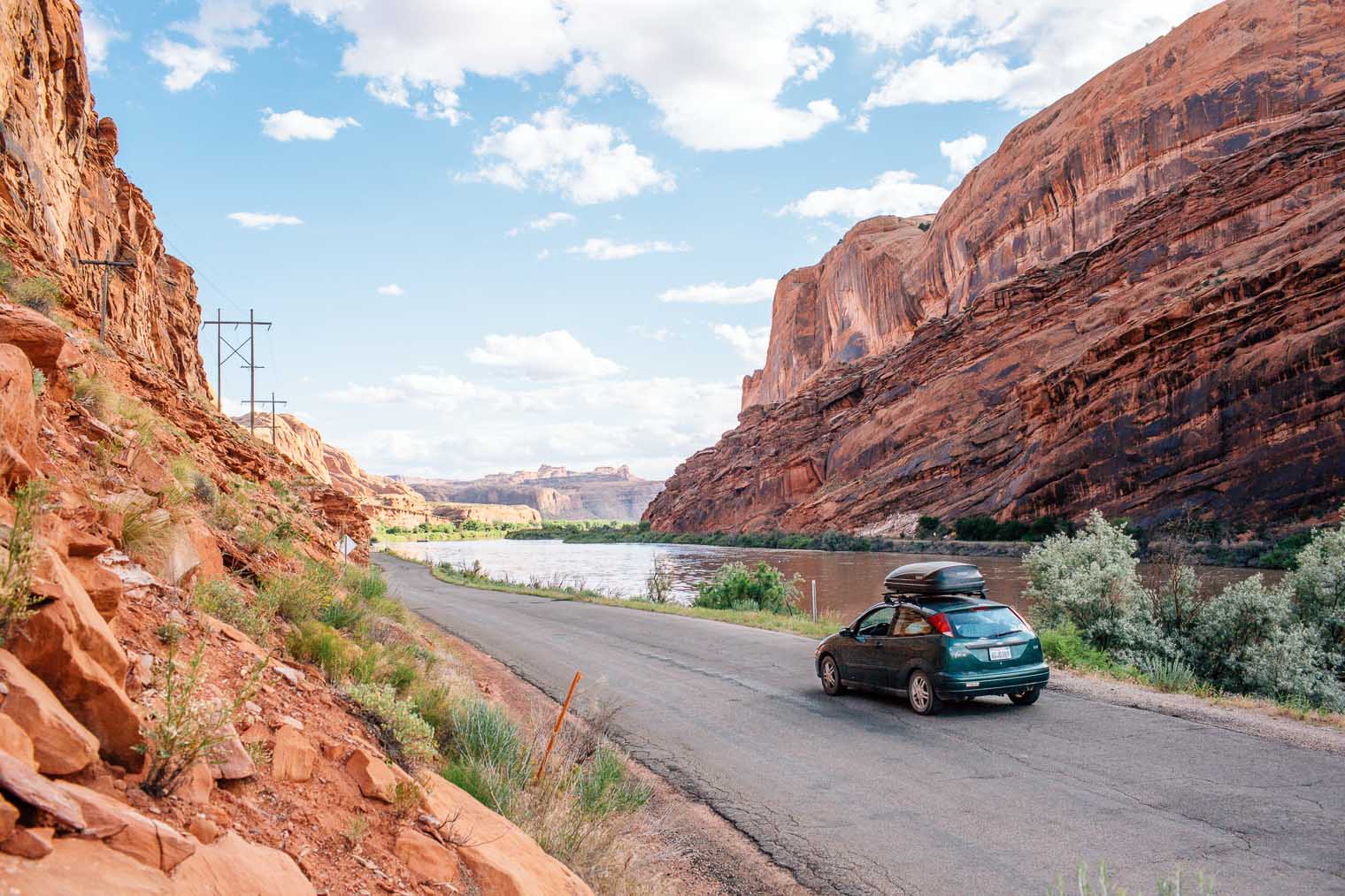
2. Upper Colorado Scenic Byway 128 to Cisco
Summary: This beautiful stretch of road is known as “River Road” to the locals, and can be picked up just north of town. The road follows a narrow red rock canyon that’s been carved out by the Colorado River, before opening up and transitioning into an open desert landscape. This road will lead you to the semi-abandoned ghost town of Cisco. This route is also a good one to do in reverse (starting in Cisco and ending in Moab) if you’re heading into Moab from the 70.
Itinerary
Matrimony Springs (.2 miles in): Before you even get going, you’ll see pulloff on the right for Matrimony Springs. This natural spring emerges straight from the rock, with fresh-tasting water that can be used for drinking. Fill up your water bottles and proceed down the road.
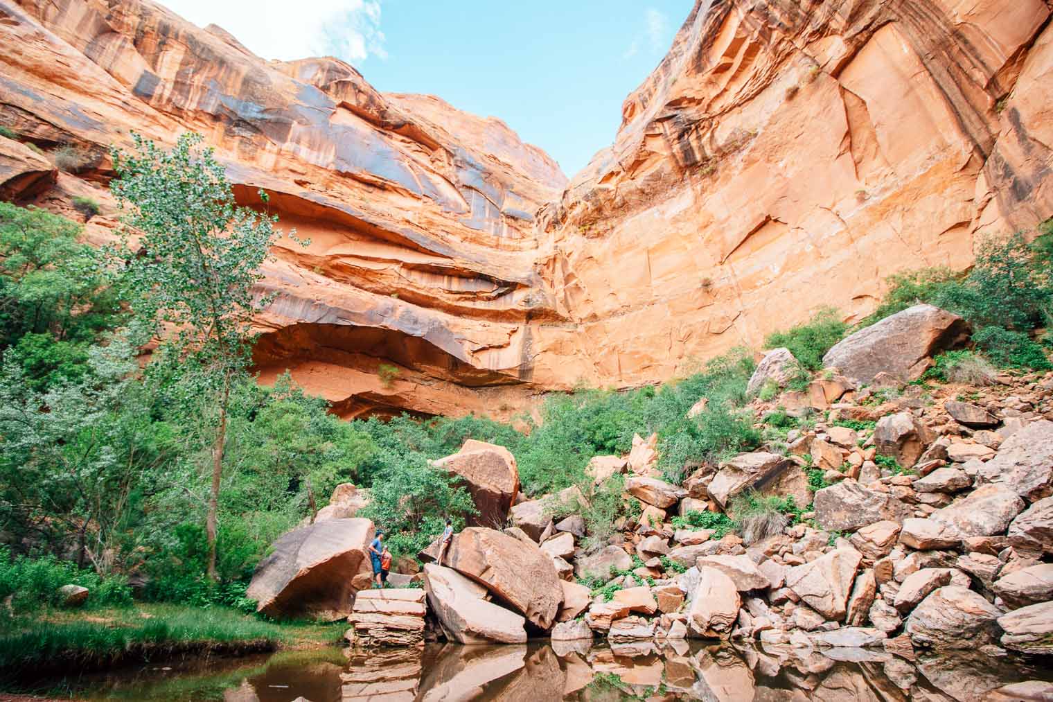
Grandstaff Canyon (3.6 miles in): Soon you’ll arrive at Grandstaff Canyon. If you’re looking to go hiking, this a great spot because the narrow canyon remains well-shaded throughout the day. There’s a trail that leads back into the canyon and about 2 miles in you’ll arrive at Morning Glory Natural Bridge.
Fisher Towers (21.6 miles in): After the canyon widens, you’ll will see Fisher Towers in the distance off to your right. These massive 1,500 tall spire are an iconic southwestern vista and have been featured in a variety of western films. There are a variety of hiking trails that depart from here, as well as a bunch of technical climbing routes.
Lower Onion Creek Campground: This amazing campground offers spectacular views of Fisher Tower and the surrounding red rock canyon.
Dewey Bridge (30 miles in): To your right, you will pass the remains of historic Dewey Bridge. Constructed in 1916, the bridge was in operation until 2008, when it was destroyed by a brush fire. Now all that is left is the steel frame and cable wiring.
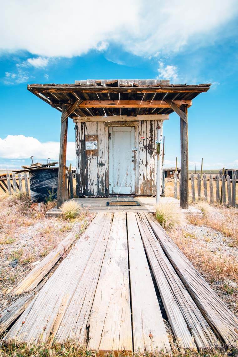
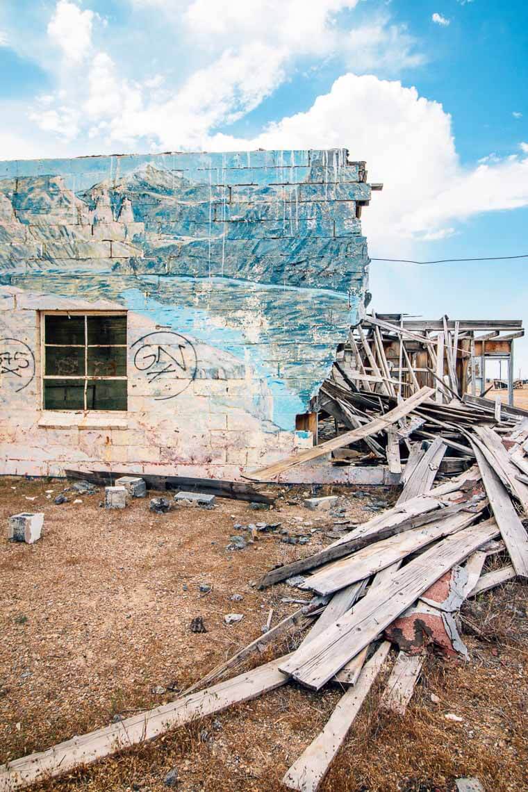
Cisco Ghost Town (40 miles): Finally, you will arrive at the ghost town of Cisco, which was once used as a water refueling station for the railroad. We’re not sure exactly when Cisco was “abandoned” but it doesn’t look like it was that long ago. There are some collapsed homes and vehicles from the 1990’s that have fallen into decay. Actually, there seems to be a few people still living in a couple of the dilapidated homes. If you’re looking for a classic old western ghost town, this is not it. This place definitely has more of a Mad Max dystopian vibe, which is cool. In its own special way.

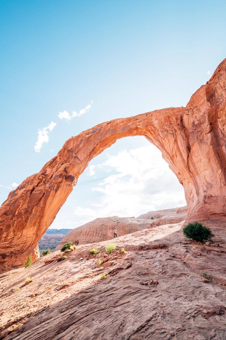
3. Potash Lower Colorado Scenic Byway (Route 279) to Corona Arch
Summary: Also known as Potash Road, this scenic route can be picked up north of town and will take you along the western edge of the Colorado River. While it offers some of the same vistas as Kanye Creek, it has a lot of different roadside attractions including: rock climbing, dinosaur tracks, and a massive stone arch.
Itinerary
Wall Street: Shortly after the road joins up with the Colorado River, you’ll arrive a popular spot for rock climbing called Wall Street. Here you’ll be able to spot plenty of individuals scaling the red cliffs along the side of the road.
Petroglyphs (5 miles in): A little after the main climbing areas on Wall Street, you’ll see a pull-off on the left side of the road where you can view petroglyphs etched into the cliff. Strangely, the etches have been carved about 30 feet off the ground, which led us to wonder how the artist got up there. But apparently, before the road was constructed, there was a sand embankment that made the etching roughly ground level.
Dinosaur Tracks (6 miles in): Michael was super excited to see this! A little bit further, after the petroglyphs, you’ll see signs on the right side of the road indicating dinosaur tracks. A dirt driveway leads to a parking lot. From here you can follow a short trail up to three-toed dinosaur footprints that have been captured in stone.
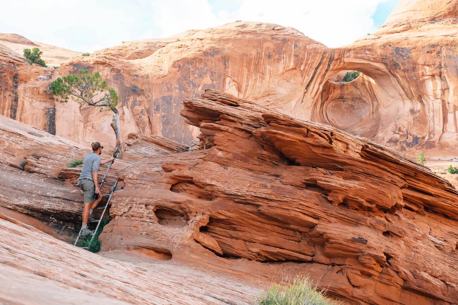
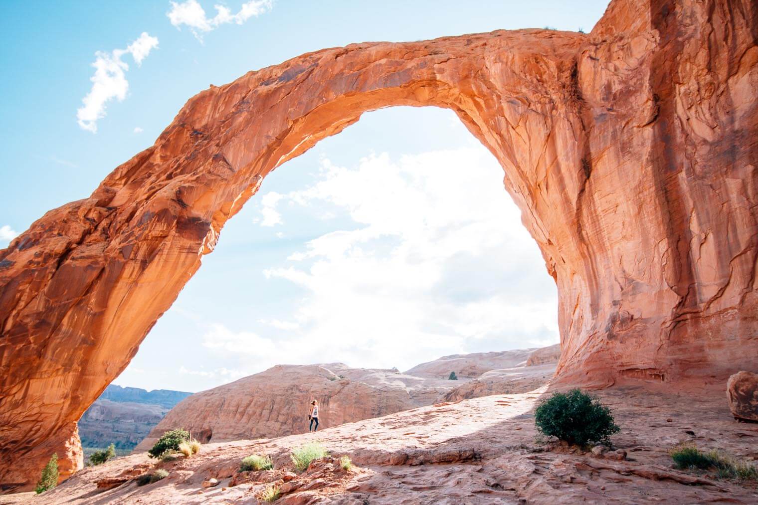
Corona Arch & Bowtie Arch (11 miles in): This is definitely the main attraction of this drive, and one of our favorite short hikes in Moab. It’s a 3 mile hike out that covers some moderately strenuous terrain, but it is so worth it! You’ll cross a railroad track (there are no bells at the crossing, so please use caution), scramble up steps carved in stone and a short ladder, before arriving at one of the most spectacular arches outside of Arches National Park. This arch is so big that legend has it that a local man uses to fly his single-prop airplanes through it!
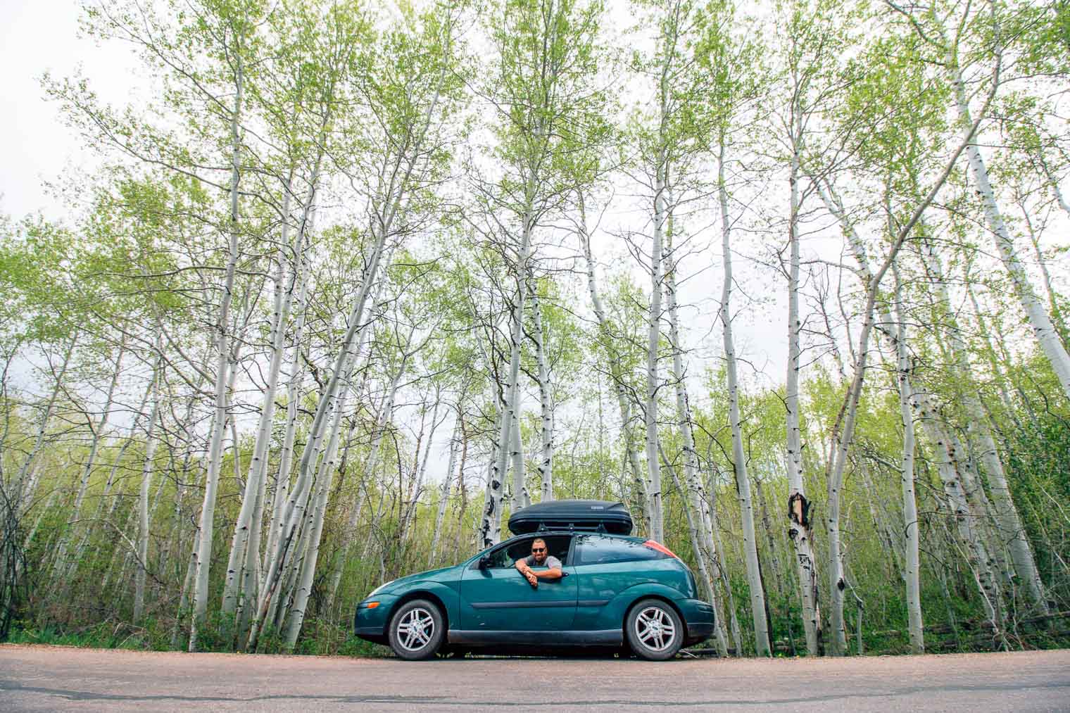
4. La Sal Mountain Mountain Loop
Summary: This half-day drive lets you experience the area’s incredibly diverse scenery and is one of the most underrated things to do in Moab, in our opinion. It starts in the red rock canyons and slowly makes its way up into the green alpine forest of the La Sal range. The temperature in the mountains is dramatically cooler than down in Moab, which makes this drive an excellent choice during the hot summer months. If you’re looking to escape the dusty desert and explore the lush forest, then this drive is for you!
Itinerary
The Priest, The Nuns & Castle Rock: Shortly after passing the tiny town of Castle Valley, you will see some dramatic rock formations to your left. The Priest comes first, followed by “the Nuns”, with Castle Rock towering directly ahead.
Warner Lake & Campground (21 miles in): This beautiful mountain lake is situated amidst pines and white-barked aspens. The temperature up here is usually 20 degree cooler than down in Moab, so it can be wonderful place to escape the heat. There is also a campground and cabin here that can be rented via Recreation.gov.
The lake is not directly on the La Sal Mountain Loop road. About 28 miles after turning off highway 191, you’ll see Warner Lake Road on your left. Continue down this dirt road for approximately 4 miles and you will arrive at the lake.
Mt. Peale Hike (45 miles in): If you’re interested in extending your drive, you might consider heading out over La Sal Mountain Pass. You’ll see a marked sign on your left that leads back into the mountains. From here you can access the trailhead for Mt. Peale – the tallest mountain in the the range.
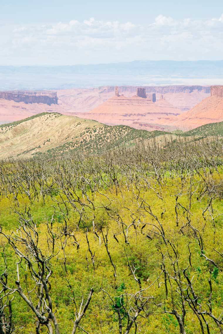
5. Dead Horse Mesa Scenic Byway
Summary: With Canyonlands and Arches being so close, Dead Horse State Park is often overlooked. However, it offers one of the most spectacular vistas in the entire Moab area. While we visited in the mid-afternoon, this is an amazing place to catch sunset. According to the website, it is one of the most photographed vistas in the entire world. (We’re not entirely sure how they calculate that, but we aren’t going to argue. It was pretty spectacular.)
There is a $10 fee to enter Dead Horse State Park. They take both cash and credit card.
Itinerary
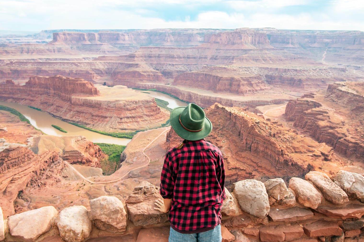
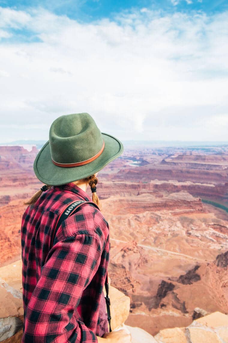
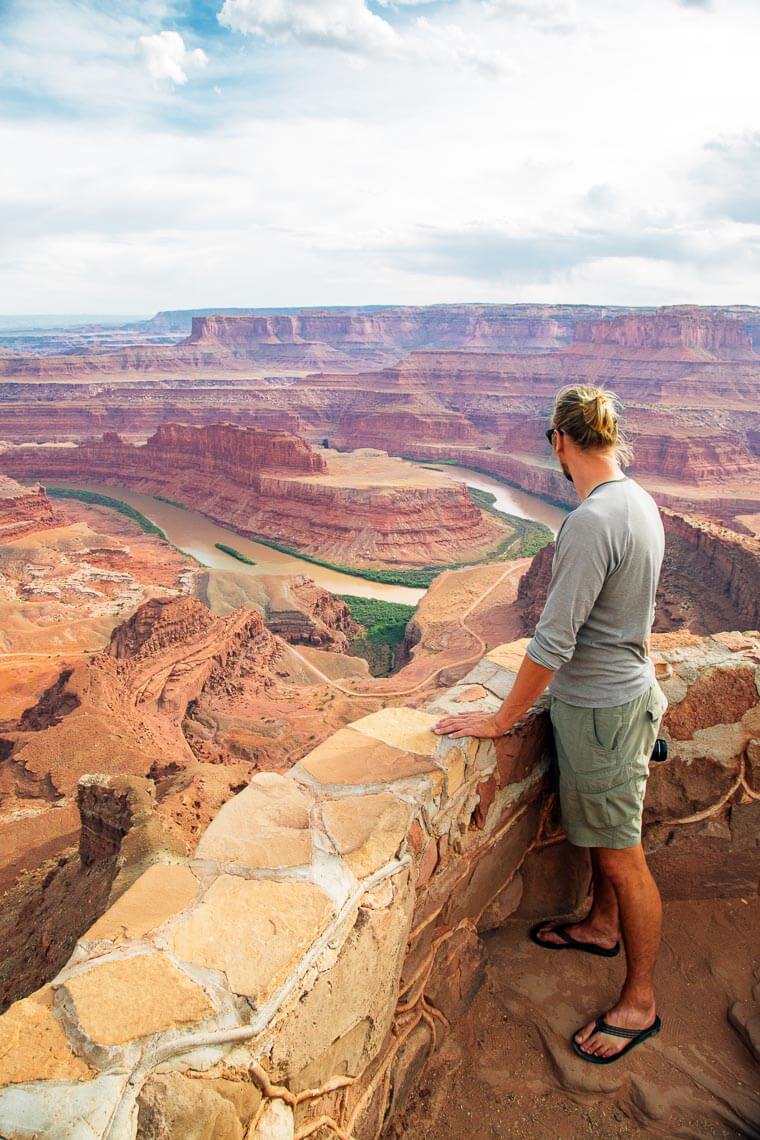
Dead Horse Point Overlook: A peninsula of rock perched on the edge of immense sandstone cliffs, this scenic point is connected to the rest of the mesa by just a 30 yard neck. Cowboys used to herd wild mustangs onto the point and stack brush across the narrow isthmus to prevent them from escaping. They would then select the horses they wanted to keep and release the rest. On one tragic occasion, the cowboys left without releasing the rest of the herd. Without any water source, the horses all died of thirst, despite being in sight of the Colorado River 2000 feet below. Hence the name: Dead Horse Point.
The overlook has a variety of paved walking paths, that visitors can explore and take in the panoramic views of the red rock canyons that have been carved by the Colorado River.
Rim Trail Hike (5.2 miles): If you have some more time to spend in the park, consider hiking the Dead Horse Point rim trail. You can read the trail notes and see a map here.
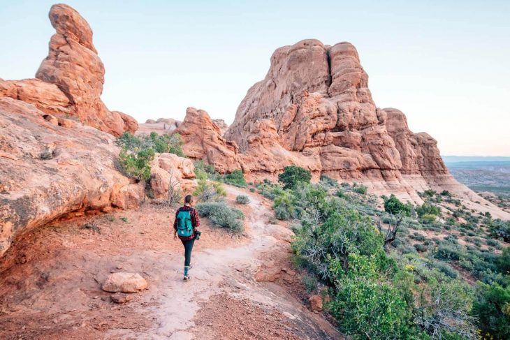
6. Arches National Park Scenic Drive
Summary: In terms of scenic drives in the area, the main road through Arches National Park is the most famous. However, it is also the most crowded. You will need to reserve a timed entry ticket in advance to be able to visit. Despite the ticketed reservation system, parking in the park is very limited, so try to snag the earliest entry you can! Not only is the park more manageable early in the morning, but the temperatures are much cooler. The rising sun also brings out the red in the rocks, adding to the dramatic landscape.
Itinerary
Clearly there’s a lot to do in Arches National Park and it’s a classic stop during any Utah National Parks road trip. Here are some of the places we visited and enjoyed.
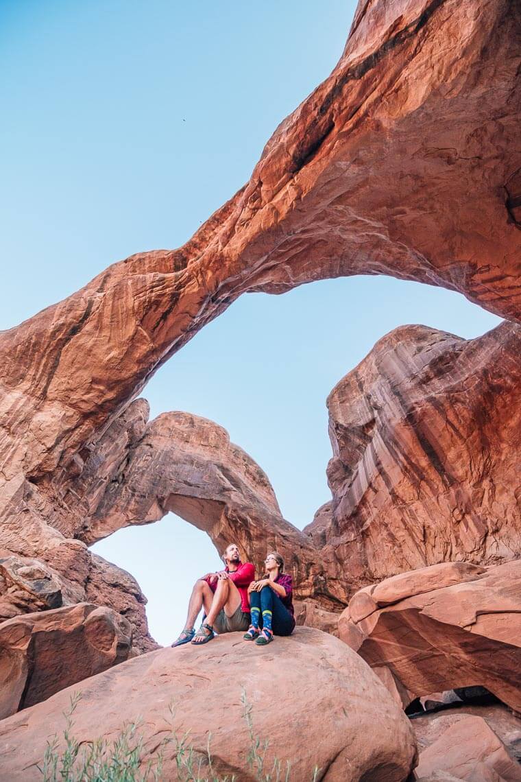
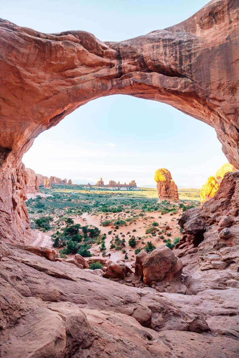
Double Arch: We actually came here to see Window Arch for sunrise. Apparently, the sun rises through the arch, which makes for a spectacular photo. However, there was a small crowd of photographers already there when we arrived. Rather try to jockey for position so we could take the exact same picture as two dozen other people, we decided to take a short walk over Double Arch. Nobody was there, so we got to climb around and explore without being disturbed.
Delicate Arch: This is perhaps the most famous arch in the entire park. By the time we got to the trailhead, the parking lot was already mobbed so we decided to skip it. Although if you arrive early enough, we’ve been told by friends that it’s a spectacular experience.
Devil’s Garden (Landscape Arch): This hike can be found at the very end of the Arches Scenic Drive. There are a variety of trails, which range from a short out and back to a more substantial half-day loop. Here, you’ll pass through incredible rock fins, which keeps the trail relatively shaded. This is also how you access Landscape Arch, which is even more precarious looking than delicate arch.
We had an awesome time in Moab, and we’ll definitely be back. If you have any suggestions of things that we missed and should check out next time, let us know in the comments below!
Utah is simply stunning. One of my favorite states (though I do have quite a few!) Coming from a country with a fair share of desert (Israel) we weren’t expecting much on our first visit there but boy, we were in for a huge surprise. Utah is nothing short of amazing. We returned to Utah twice after that and I’m sure we’ll be back for more in the future!
Thanks for sharing these drives. I am so bookmarking this page!
As far as we’re concerned, all of southern Utah might as well be a National Park. (We haven’t even gotten to Northern Utah yet!) Even just the sights from the highways are amazing. You definitely have to strain yourself to find something incredible in that part of the country!
How does the desert topography of Utah compare to Israel? We would love to visit there someday!
Oh, I agree! I had to drive my husband and his brother from Hurricane (where we had a vacation rental for the week) into Zion NP and back (they hiked the difficult trails) a couple of times. I told them I had no problem repeating the drive as many times as they needed me too. It was “just” a regular Utah road but had it been anywhere else, it would have been designated as an official scenic drive.
Israel is extremely diverse for such a small country. It’s not all desert. We have forests, rivers, waterfalls, awesome beaches and even one snowcapped mountain during winter time. Most people live in these areas (mostly the coast) so you have to drive out to actually see the desert. The deserts are diverse. Very few sand dunes and a bunch of fairly impressive geological features. The Dead Sea is the lowest place on earth and it’s right by the Judea mountains, so the decline creates some pretty awesome canyons to hike in, many with streams and waterfalls. We have two huge craters, the only ones in the world created erosion. The larger one reminds me of the Grand Canyon and the road goes through it, so you can hike inside the crater for some pretty interesting features (like a wall of fossilized ammonites) and you have the area of the red Eilat mountains which is pretty awesome in its own right. Blue sea with corals and amazing fish and right next to it, Timna and Solomon’s pillars. Maybe I should write about these on my blog sometime 😉 We’ve been to all these places so I can share some photos too.
I’m sure you wouldn’t get bored traveling in Israel 😉 It can be expensive though but if you’re ok with couchsurfing, people are happy to have travelers stay with them. Let me know if you come, we host couchsurfers too 😉
I so wish I’d had about, oh, two weeks more to explore Utah on our recent trip out there! Thanks for letting me live vicariously through you two.
Your photographs are breathtaking!
Oh my gosh- I was just in Utah at Arches ans Canyonlands and wish I’d seen this before (oops). It RAINED every afternoon (whaaaat!?). But anyway I did get up before sunrise and go hike delicate arch and it was SO WORTH IT! Super amazing. The Devil’s Garden trail had me thinking I was going to die in the desert, but we made it 😉 lol. Gorgeous state!
Thank you so much for this helpful advice & suggestions. I’m taking my 77 year old mom our to SLC to visit my sister n her husband who just recently moved out there. Then my mom and I are driving down to Moab. We leave first week of June, I know, it’s HOT and crazy busy. This all helps reassure me that it’s not all hiking. I love to hike, but mom can’t walk down or up strenuous terrain too much.
Hello from Moab! Just wanted to say that you showcased our area really well. We love showing visitors these same spots – most people don’t have 4WD when they arrive; but they still want to see all the grooviness. Good job! ☺
Thanks! Glad to have a bit of local approval. Probably best to not overcrowd the 4WD trails anyways, especially with so much great stuff that can be seen from the road.
Hi Great article, am returning to Utah in the Fall, first visited from the UK back in 2008 so this will help my plans.